


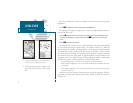
1. Press the
J
key.
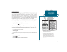
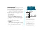
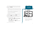
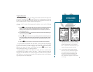
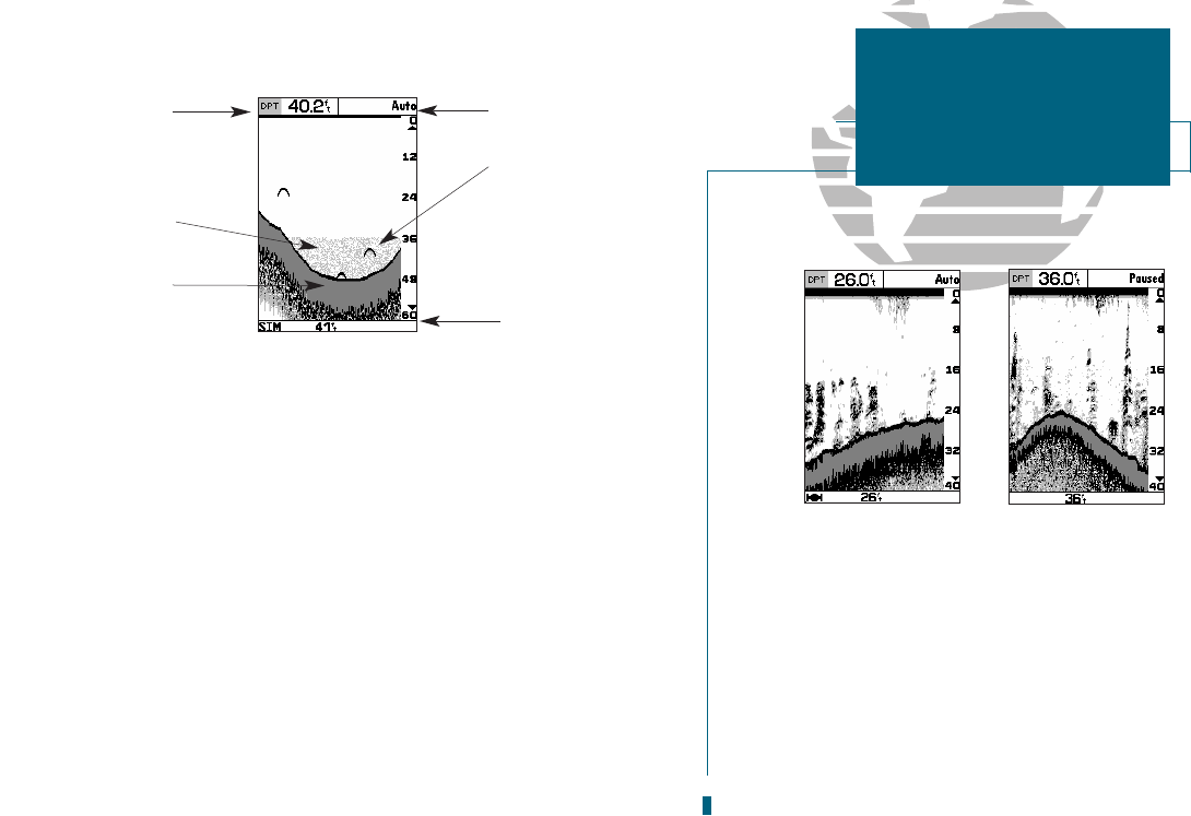
The sounder page lets you use the GPSMAP 185 as a fishfinder. The top of the screen
contains any of thirteen selectable data field options, while the middle of the page contains a
right-to-left moving sonar image of the water beneath your boat. (Note: Items appear on the
screen as they pass under your transducer. Those objects appearing on the right side of the
screen are closer to you than those on the left.) Fish are displayed as a darkened arch or a
fish icon in three different sizes. Thermoclines (layers of water separating warmer water
above from cooler water below) are shown as shades of gray.
The area of strongest sonar return (or whiteline) is displayed as a solid gray. Typically, the
bottom will be the primary source of the whiteline. A thin whiteline indicates a softer bot-
tom while a thick whiteline shows a harder bottom. A black line is used to show the point
where water meets the whiteline. This black line will follow the bottom contour, along with
any significant objects lying on the bottom. Along the right side of the screen is an adjustable
scale which reflects the depth of the area being displayed. The status bar at the bottom of the
page displays satellite signal status, digital depth, and any triggered alarms. More on the
sounder page may be
found on pages 25-35.
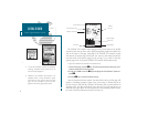
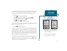
A. When adjusted correctly, the bottom is out-
lined by the whiteline. To adjust the whiteline,
see page 30.
B. Pause the screen by pressing the EDIT/ENTER
key at any time. To continue screen move-
ment, press EDIT/ENTER again.
Pausing is used to allow more time to examine
the screen display and is necessary when using
the underwater waypoint function.
7
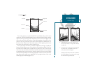
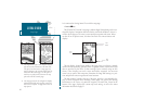
GETTING STARTED
Sounder Page
A
B
Data Field
Range Mode
Fish Arch
Thermocline
Status Bar
Whiteline