


Almanac DataThe satellite constellation information (including location and health of
satellites) that is transmitted to your receiver from every GPS satellite. Almanac data must
be acquired before GPS navigation can begin.
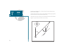
Bearing (BRG)The compass direction from your position to a destination.
Course Over Ground (COG)
Direction of movement relative to a ground position.
Crosstrack Error (XTK)The distance you are off a desired course in either direction.
Desired Track (DTK)The compass course between the from and to waypoints.
Differential GPS (DGPS)An extension of the GPS system that uses land-based radio bea-
cons to transmit position corrections to GPS receivers.
Estimated Time of Arrival (ETA)The time of day of your arrival at a destination.
Estimated Time Enroute (ETE)The time remaining to your destination at your present
speed.
GridA coordinate system that projects the earth on a flat surface, using square zones for
position measurements.
Ground Speed (SOG)The velocity you are traveling relative to a ground position.
LatitudeA north/south measurement of position perpendicular to the earths polar axis.
LongitudeAn east/west measurement of position in relation to the Prime Meridian, an
imaginary circle that passes through the north and south poles.
PositionAn exact, unique location based on a geographic coordinate system.
Turn (TRN) The difference and direction in degrees between the bearing to your desti-
nation and your course over ground. The TRN value is used to indicate what direction, and
how many degrees, to turn to get back on course.
77
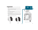
SECTION
E
APPENDIX
Glossary