


AB
The following options are available for the Navigation Page:
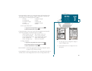
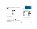
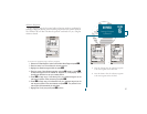
Change Data Fields? allows you to define the data displayed in any of the six
user-selectable data fields. Ten data options are available:
BRG bearing to active wpt DIS distance to active wpt
SOG speed over ground COG course over ground
ETE estimated time enroute ETA estimated time of arrival
XTK crosstrack error VMG velocity made good
TRN turn angle to wpt CTS course to steer
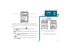
To change a data field:
1. Highlight the Change Data Fields? option and press
T
.
2. Highlight the field you want to change and press
T
.
3. Select the desired data field option and press
T
.
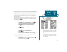
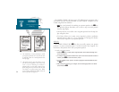
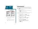
Configure Highway? allows you to select what waypoints are shown on the high-
way display. Four options are available:
Nav & Nearest Waypoints all route and nearest waypoints displayed
Nav Waypoints only waypoints in the active route will be displayed
Active Waypoint only the active waypoint will be displayed
No Waypoints no waypoints will be displayed
To configure the highway display:
1. Highlight the Configure Highway? option and press
T
.
2. Select the desired option and press
T
.
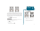
Restore Defaults? resets all navigation page options to the factory settings.
Setup Simulator? allows you to define speed, course, and position values while in
simulator mode. See pages 4-16 for more details on using simulator mode.
Auto COG? allows you to reset automatic steering while simulating navigation
and cancel any course adjustments made with the
R
keypad.
32
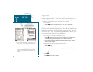
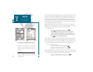
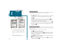
A. Ten data options are available for each data
field on the Navigation Page. The digital
crosstrack error option is especially useful to
display the exact distance you are off course
in feet/miles or meters.
B. To select what waypoints appear on the
graphic highway, highlight the desired setting
and press EDIT/ENTER.
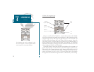
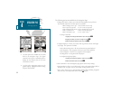
SECTION
4
NAVIGATION PAGE
Nav Page Options