


10 GPSMAP 5000 Series Owner’s Manual
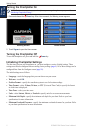
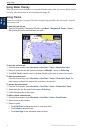
Using Charts
USinG
ChartS
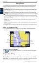
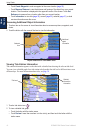
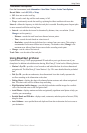
Touch Create Waypoint to mark a waypoint at the cursor location (page 25).
Touch Measure Distance to view the distance and bearing of the object from your current
location. The information is displayed in the upper-left corner of the screen. Touch Set
Reference to measure from a location other than your current location.
Touch Information to view tide (page 30), current (page 30), celestial (page 31), or local
services information near the cursor.
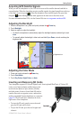
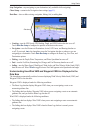
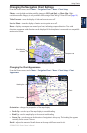
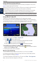
Accessing Additional Object Information
1. Touch an item on the screen to view information about on-screen map items, waypoints, and
charts.
2. Touch the button with the name of the item to view the information.
Object Selected on a GPSMAP 5208
Selected
item
Additional
object
information
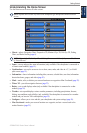
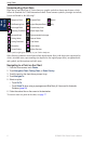
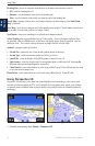
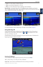
Viewing Tide-Station Information
Tide-station information appears on the chart with a detailed icon showing the relevant tide level.
You can view a detailed graph for a tide station to help predict the tide level at different times or on
different days. For more information about tides, see page 30.
Tide level
Detailed
tide station
information
Tide Station Selected on a GPSMAP 5208
1. Touch a tide station icon ( ).
2. To view a detailed tide graph:
Touch the button with the station name.
Touch Review if more than one item is in the vicinity, and then touch the button with the
station name.
•
•
•
•
•