


Northstar M121/M84 Installation and Operation Manual24
Tracking records the boat’s position to memory
at regular intervals, which can be:
Time intervals.
Or distance intervals.
The track of where the boat has been can be
displayed on the chart. The Instrument can
display one track while recording another.
To work with tracks, see section 19-7.
The Instrument can store five tracks:
Track 1 can hold up to 2000 points and is
intended to record the normal progress of
the boat.
Tracks 2, 3, 4 and 5 can hold up to 500 points
each and are intended to record sections to
be retraced accurately, for example entering
a river mouth.
Tip: Record a reference tracks and then use
the track to help navigate the same trip later.
For example, record a reference track as you
leave harbour. Then if you return to harbour and
visibility is poor, select the chart and navigate
manually along the reference track back into
the harbour. Record reference tracks in good
conditions.
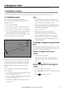
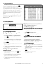
3-5 Tracks and tracking
When recording is on and the track becomes
full then recording continues and the oldest
points in the track are deleted. The maximum
length of a track depends on the selected track
interval: a small interval will give a shorter, more
detailed track and a long interval will give a
longer, less detailed track, as shown in these
examples:
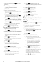
Time intervals
Interval Track 1 Track 2, 3, 4 or 5
1 sec 33 minutes 8 minutes
10 sec 5.5 hours 1.4 hours
1 min 33 hours 8 hours
Distance intervals
Interval Track 1 Track 2, 3, 4 or 5
0.01 20 5
1 2,000 500
10 20,000 5,000
The track lengths are in the current distance units, for example
nm.
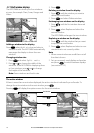
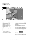
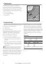
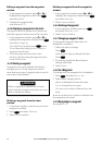
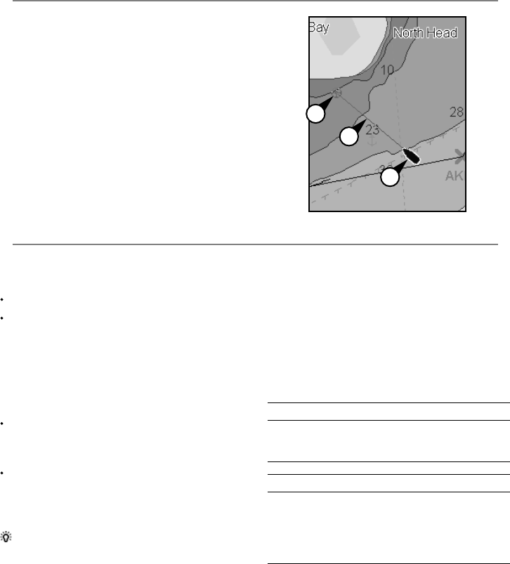
If Projected course is turned on, then the
Instrument will display the projected position
based on the course over ground (COG), speed
and a specified time. To turn Projected course
on and off and to set the time, see section 19-2.
A Projected position
B Boat’s projected course
C Boat position
3-4 Projected course
A
C
B