


89
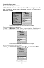
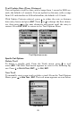
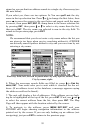
Trail Visible/Invisible and Other Trail Options
The name, maximum number of points in the trail, activity, and visibility
are all changed on the Edit Trail screen. The Active setting determines
whether or not iFINDER is recording new points for a particular trail.
On the Edit Trail menu, press ↓ or ↑ to highlight the section you wish
to change, then press
ENT. Make your changes, then press EXIT to erase
this menu.
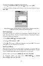
You can also change the trail line color and pattern. For instructions,
see the entries on Edit a Trail Color and Edit a Trail Pattern in Sec. 4,
Advanced GPS Operations.
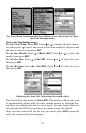
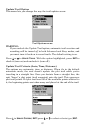
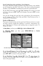
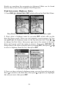
Units of Measure
This menu (shown below) sets the speed and distance (statute or nauti-
cal miles, meters), depth (feet, fathoms, or meters), temperature (de-
grees Fahrenheit or Celsius) and heading (true or magnetic) units. To
change the units:
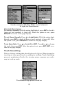
In
Easy Mode, you first press MENU|↓ to UNITS OF MEASURE|ENT.
In
Advanced Mode, you first press MENU|MENU|↓ to SYSTEM
SETUP|ENT|ENT.
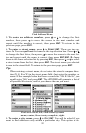
At left, Units of Measure command on System Setup menu. At right,
Units of Measure Menu.
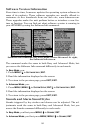
To set Speed/Distance Unit of Measure: Press ENT. Press ↑ or ↓ to
change the Speed/Distance, then press
ENT. After the option is set,
press
EXIT|EXIT to return to the page display.
To set Heading: Press ↓ to
HEADING|ENT. Press ↑ or ↓ to change the
heading, then press
ENT. After the option is set, press EXIT|EXIT to re-
turn to the page display.