


21
Reference
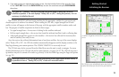
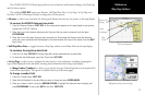
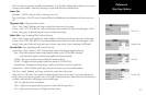
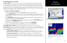
Map Page Options
sible. Use this setting when in shaded environments. “For Sunlight” displays more vibrant colors for use
in sunny environments. BlueChart data may be used with either color model mode.
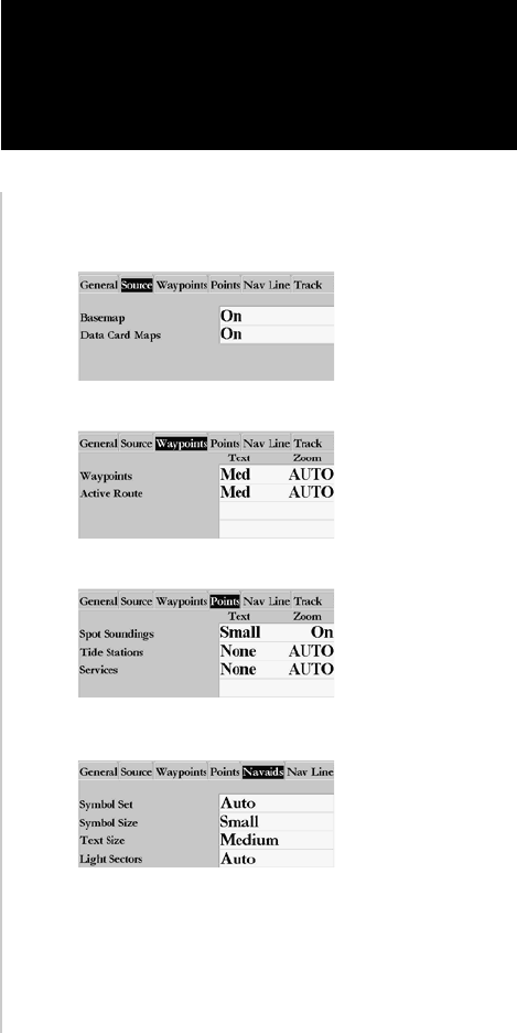
Source Tab
Basemap— On/Off: turns the built in base map on or off.
Data Card Maps— On/Off: turns all optional BlueChart/MapSource data loaded on the data card on or
off.
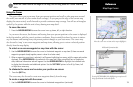
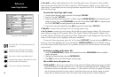
Waypoints Tab— Waypoints/Active Route
Text— None, Small, Medium, and Large: controls the screen size of the name.
Zoom— Auto, Off, 120 ft.-800 mi.: sets the maximum scale at which the feature should appear on the
screen. Some types of data will only show up to certain zoom scales.
Points Tab—
Spot Soundings/Tide Stations/ Services
Text— None (except Spot Soundings), Small, Medium, and Large: controls the screen size of the name.
Zoom— Auto, Off, 120 ft.-800 mi.: sets the maximum scale at which the feature should appear on the
screen. Some types of data will only show up to certain zoom scales. (Spot Soundings On/Off only)
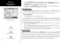
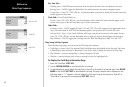
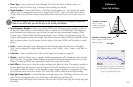
Navaids Tab—
Spot Soundings/Tide Stations/ Services
Symbol Set—
Auto, Garmin, NOAA, International: controls the desired navaid symbol set.
Auto - BlueChart maps are drawn using symbols similar to the NOAA/NIMA standard.
Non BlueChart maps are drawn using traditional Garmin symbols.
Garmin - All maps are drawn using traditional Garmin symbols.
NOAA - All maps are drawn using a symbol set similar to NOAA/NIMA.
International - All maps are drawn using a symbol set similar to the IALA symbol set.
Symbol Size— Small, Medium, and Large: controls the screen size of the navaid symbols.
Text Size— Small, Medium, and Large: controls the screen size of the name.
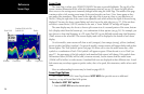
Light Sectors— Off, Auto, On: controls the drawing light sectors on the map. Color units indicate the
actual color of each sector using the color of the light. Monochrome units draw white and yellow sectors
as white, and draw blue, red & green sectors as dark gray.
Off— No light sectors are ever drawn
Auto— Light sectors appear when you point to them with the map cursor.
On— Light sectors are drawn for all lights that have them.
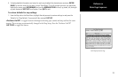
Source Tab
Waypoints Tab
Points Tab
Navaids Tab