


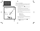
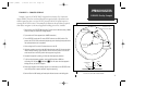


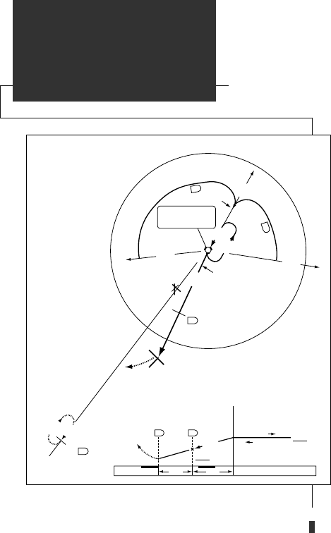
EXAMPLE 4— RADAR VECTORS TO FINAL APPROACH COURSE
Example 4 uses the same VOR/DME RWY 21 approach into Topeka/Forbes Field
Airport (KFOE) used in example 3 and illustrates an approach using radar vectors to
a point 3 miles out from the final approach fix. To fly a radar vector approach, you
must still select a desired approach and IAF from the database and set the GPS SEQ
switch to HOLD while you fly the vectors to the active approach waypoint. To
accommodate radar vectors, the GPS 155 allows manual selection of any approach
waypoint as the destination waypoint.
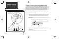
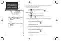
1. Select and arm the desired approach and initial approach fix. Enter the current altimeter
setting of the destination airport when the ‘Need pres- press NAV’ message appears.
2. When you are advised by the controller that you will be receiving radar vectors to the final
approach course:
• Activate the final approach fix waypoint from the Active Route page:
a. Press the
R
key and rotate
O
until the Active Route page appears.
b. Press
C
to activate the flashing cursor.
c. Rotate
O
until the ‘ff’ (FAF) waypoint flashes.
d. Press
D
, followed by
E
.
• Set the GPS SEQ switch to the HOLD position.
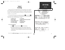
3. Set the 200º inbound course on the HSI. As the CDI needle begins to center to the final
approach course, set the GPS SEQ switch to the AUTO position to resume automatic way-
point sequencing.
4. Complete the approach by landing or perform the missed approach procedure.
78
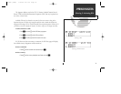
APPROACH NAVIGATION
Radar Vector Example
DO NOT USE FOR NAVIGATION
25
TOP
7
TOP
7
7
T
O
P
T
O
P
0
4
8
°
2
2
8
°
205°
205°
1 MIN
200
°
205°
IAF
TOPEKA
R-258
(IAF)
2600
(7)
(IAF)
R
-0
9
4
3000
205° (7)
A
rc
A
rc
3
0
0
0
3
0
0
0
N
o
P
T
NoPT
ERASE
VOR/DME RWY 21
TOPEKA
/FORBES FIELD(FOE)
5 NM 7 NM
MISSED APPROACH
CLIMB TO 3000 VIA HEADING
240° AND TOP R-213 TO
ERASE 25 DME AND HOLD.
3000
2600
200°
12
7
TOP TOP
VORTAC
ONE MINUTE
HOLDING PATTERN
025°
205°
155man (GOOD) 7/24/98 1:57 PM Page 78