


28
Reference
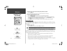
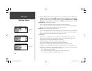
Map Page: Options
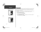
4. To display detailed information/notes for each area or to turn individual maps in the family on/off,
highlight the family name and press ENTER. To view the notes for that area, choose ‘Show Notes’.
To scroll through the notes, you may either highlight the notes, press ENTER and use the ARROW
KEYPAD to scroll UP, DOWN, LEFT and RIGHT or press MENU and choose the desired scroll option.
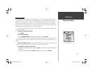
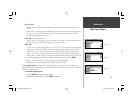
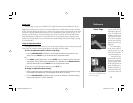
Waypoints Tab— Waypoints/Active Route
Text— None, Small, Medium, and Large: controls the screen size of the name.
Zoom— Auto, Off, 20 ft.-800 mi.: sets the maximum scale at which the feature should appear on
the screen. Some types of data only shows up to certain zoom scales.
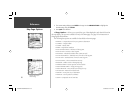
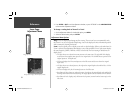
Points Tab
— Spot Soundings/Tide Stations/Services
Text— None (except Spot Snd.), Small, Medium, and Large: controls the screen size of the name.
Zoom— Auto, Off, 20 ft.-800 mi.: sets the maximum scale at which the feature should appear on
the screen. Some types of data only shows up to certain zoom scales.
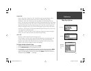
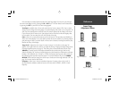
Navaids Tab—
Symbol Set— Auto, GARMIN, NOAA, International: controls the desired navaid symbol set.
Auto - BlueChart maps are drawn using symbols similar to the NOAA/NIMA standard. Non-
BlueChart maps are drawn using traditional Garmin symbols.
GARMIN - All maps are drawn using traditional Garmin symbols.
NOAA - All maps are drawn using a symbol set similar to NOAA/NIMA.
International - All maps are drawn using a symbol set similar to the IALA symbol set.
Symbol/Text Size— Small, Medium, and Large: controls the screen size of the symbol/name.
Light Sectors— Off, Auto, On: controls the drawing light sectors on the map. Color units indicate
the actual color of each sector using the color of the light.
Off— No light sectors are ever drawn.
Auto— Light sectors appear when you point to them with the map cursor.
On— Light sectors are drawn for all lights that have them.
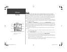
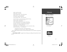
Waypoints
Ta b
Points Tab
Navaids Tab
GPSMAP178CManual.indd 28 3/19/2004, 3:10:09 PM