


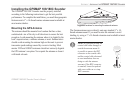
GPSMAP 188/188C Sounder Owner’s Manual 101
APPENDIX > SATELLITE INFORMATION
Satellite Information
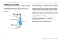
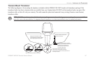
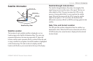
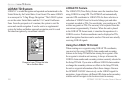
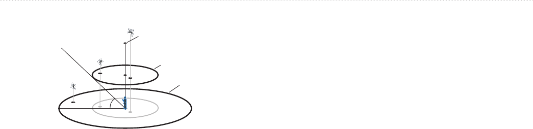
Satellite Sky View
45°
90°
Outer ring -
the horizon
Inner ring- 45°
above the horizon
Center dot - 90°
above the horizon
Satellite Location
The location of each available satellite is displayed over two
location rings on the Satellite Information Page. The outer ring
represents the horizon, the inner ring represents 45° above the
horizon, and the center represents directly overhead. When the unit
is using a satellite for navigation, the satellite number is highlighted
on the location rings. The unit can be set to display satellite
location with North or your current track at the top of the display.
Satellite Strength Indicator Bars
The Satellite Strength Indicator Bars show the strength of the
signal being received, and the status of the signal. The bars are
either shaded or filled. The gray bar means the GPS is in the
process of storing orbital data it is receiving from the satellite
signal. When the bar turns solid, the GPS is using the satellite
signal for navigation. A “D” in or above the bar means that
differential corrections (WAAS or DGPS) are being applied to that
satellite.
Date, Time, and Current Location
The GPS gets date and time information from the satellite’s on-
board atomic clock. When the GPS receiver has achieved a 2D or
3D GPS location, the current location is displayed in the selected
location format.