


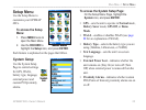
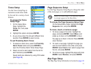
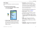
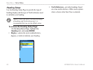
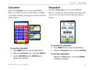

Units Setup
Use the Units Setup Page to customize measurement
units.
To access the Units Setup Page:
On the Setup Menu Page, highlight the Units
icon, and press ENTER.
Units
icon
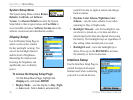
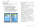
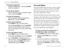
• Position Format—sets the coordinates for the
system in which a particular location is shown.
The default format is latitude and longitude in
degrees, minutes, and thousandths of a minute
(hddd
o
mm.mmm).
• Map Datum—
sets the description for
geographic location for surveying, mapping,
and navigation, and is not actually a map built
into the unit. The default setting is WGS 84.
The unit automatically chooses the best datum
based on your chosen format.
For more information about selecting position
formats and map datums, see page 82.
• Distance/Speed
—selects the unit of
measurement for speed and distance traveled.
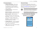
• Elevation (Vert. Speed)
—selects the unit of
measurement (Feet (ft/min), Meters (m/min),
or Meters (m/sec) to use for altitude and rate of
ascent.
• Depth
—selects the unit of measurement
(Feet, Fathoms, or Meters) to use for depth.
(Requires interface to other devices or marine
chart data.)
• Temperature
—selects the unit of measurement
(Fahrenheit or Celsius) to use for temperature.
GPSMAP 60Cx Owner’s Manual 63
MAIn Menu > setuP Menu