


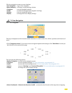
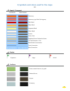

• The total calculated distance and time for the journey are given at the beginning of the driving directions.
• By clicking the up and down arrows, you can scroll through the driving directions. The map display is then
automatically centered on the change of direction given in the driving directions.
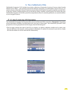
• If the GPS position is outside the limits of the map installed in the system, the GPS cross may appear in the middle of
a blank screen. By zooming out, you can then locate the GPS position in relation to the maps installed in the system.
• When “
Center on GPS position” is selected, the “Location Marker Option” function is no longer enabled. You need
to move the location marker to be able to access the function again.
• The position established by the GPS can be affected by several factors:
• the reception quality of the American satellites signals;
• the surroundings (buildings, tunnel, high-voltage cables, etc.);
• battery power levels in the ViaMichelin Navigation X-970;
• the accuracy of the GPS position calculation (± 15 m);etc.
• To prolong battery life, we advise you to leave your ViaMichelin Navigation X-970 system connected to a power
source or to recharge it after use. Similarly, a volume and screen brightness reduction favors longer battery life.
• The “
Shortest” routes take the roads in the database that are closest to the straight line between the departure point
and the arrival point.
• The “
Quickest” routes take the roads that give you a shorter driving time than the “Shortest” route. In Navigation
mode, the software only uses this type of calculation. Moreover, during short journeys, the software uses the table of
average speed settings for the 6 types of roads programmed in the map database when calculating the “Quickest”
route. Therefore, you can favor some types of road by reducing the average speeds of others or by increasing the speed
of the type to favor. However, for longer journeys (> 62 mi approximately), the program calculates the route based
on the primary network (highways and similar roads); the secondary network is only used to get from the departure
point to the primary road and from the primary network to the arrival point.
• In Free Navigation, only 2D display is available.
• When there are several stages in a route, you can click “
Go to Next Stage” to tell the system to recalculate anew
route between the GPS position and the next stage. This means you can plan a route to pass near atown, without
leaving the main roads.
• In free navigation the navigation map can be displayed facing north; the position arrow will follow the movements
of the road relative to a fixed direction, or relative to the navigation axis to maintain the direction taken facing the
top of the screen. To change this setting during navigation, at the bottom of the screen click “Navigation Actions”,
then “Display”. You can then choose between “Orient Northwards” or “Orient in the vehicle’s direction”.
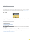
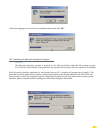
• If the PC does not detect your ViaMichelin Navigation X-970, connect your USB cable to another USB port and
check whether other PDA devices such as a Pocket PC PDA or peripherals such as a printer or a scanner that could
interfere with communication between the ViaMichelin Navigation X-970 and your PC are connected to the USB
ports. In this case, please disconnect them while installing your software.
•
You will find other information to help you get the best out of your ViaMichelin Navigation on the ViaMichelin web site:
http://www.viamichelin.us > Support
53