


57Magellan Meridian GPS Receiver
Refe rence
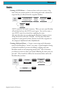
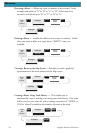
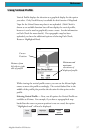
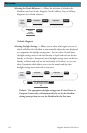
Vertical Profile displays the elevation as a graphical display for the option
you select. Only Track History is available for this function if MapSend
Topo for the United States map data is not uploaded. (Path Check is
shown as an available function but will not display the vertical profile,
however it can be used to graphically create a route. See the information
on Path Check for more details.) If a topographic map has been
uploaded, you have the additional options of selecting Path Check,
Route or Highlighted Road.
While viewing the vertical profile screen, you can use the left and right
arrows to move the profile accordingly. The vertical dashed line in the
middle of the profile plot provides the elevation for that point on the
profile.
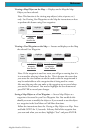
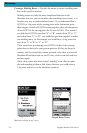
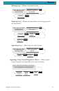
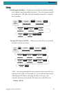
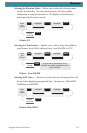
Selecting Vertical Profile — Note, not all options for Vertical Profile are
available at all times. For example, if you have a topographical map
loaded but the cursor or present position is not on a road, the option
“Highlighted road” will not be displayed.
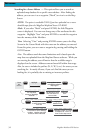
From
Any
Screen
MENU
Highlight
Vert. Profile
ENTER ENTER
Select
option
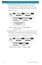
Cursor
Position
Distance from
left side to right
side of profile
Minimum and
maximum
elevations of
displayed profile