


70
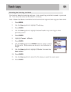
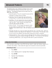
The eXplorist has a set of advanced features that provides
you with additional features to enhance the use of your
eXplorist. The advanced features are accessed from the
Main Menu and include:
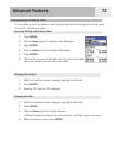
•
Area Calculation: This will compute the area and the
perimeter of a region that you define.
•
Fish/Hunt: This will display the best hunting and
fishing times for a position and date that you enter.
•
Sun/Moon: This will display the rising and setting
times for the sun and the moon for any position and
date you enter. It also displays the phase of the
moon for that position and date.
•
Vertical Profile: This will graph the elevation levels
for your active or a saved track log. (If you have a
MapSend Topo detailed map, it can also display a vertical profile of routes you have
saved.)
•
Simulate: Provides you a tool for putting the eXplorist into a simulate mode. With the
simulator turned on, the eXplorist will operate as if it was moving. This provides a tool
for you to use to try different functions while sitting at your desk or campsite.
•
Communications: This is used to set your eXplorist into the mode you desire when it is
connected to a personal computer through the USB port. You can set up file transfers,
transferring NMEA data, or just using the USB cable to power the eXplorist.
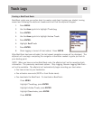
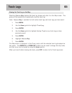
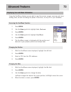
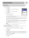
Using Area Calculation
Area Calculation uses three or more POIs that you select to create and display a region on a
miniature map display. It then takes this region and computes its area and perimeter.
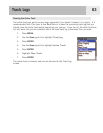
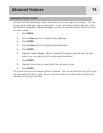
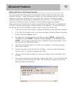
Calculating an Area
1. Press MENU.
2. Use the
Arrow joystick to highlight Adv. Features.
3. Press ENTER.
4. Highlight
Area Calculation.
5. Press
ENTER.
Advanced Features