


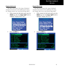

37
Part Three: Section 2
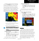
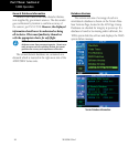
TAWS Operation
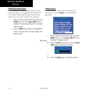
Database Updates
Terrain/obstacle databases are updated periodi-
cally with the latest terrain and obstacle data. Visit the
Garminwebsitetocheckfornewerversionsofterrain/
obstacle databases. Compare database cycle numbers
to determine if a newer version is available.
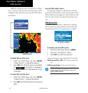
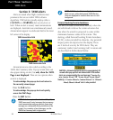
The database update process includes either
reprogramming or replacing the database card and
inserting the updated card in the right card slot on the
unit front panel. The terrain/obstacle database may
be downloaded via the internet and the card repro-
grammedusingaUSBprogrammeravailablefrom
Garmin.ContactGarminat800-800-1020orat
www.garmin.com for more information.
To update your terrain/obstacle databases:
1. Acquire a new terrain data card from
Garmin.
2. Turn off the power to the 500W Series unit.
3. Remove the old terrain data card and insert the
new card into the right-most slot of the 500W
Series unit.
4. Turn on the 500W Series unit and verify that
the TAWS system passes self-test.
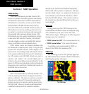
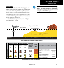
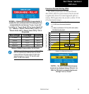
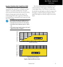
Terrain/Obstacle Database Areas of Coverage
The following describes the area of coverage avail-
ableineachdatabase.Regionaldenitionsmaychange
without notice.
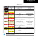
Database Coverage Area
Worldwide (WW)
Latitudes: N75° to S60°
Longitudes: W180° to E180°
United States (US)
Limited to the United States plus
some areas of Canada, Mexico,
Caribbean, and the Pacific.
US/Europe
Alaska, Austria, Belgium, Canada*,
Caribbean*, Czech Republic,
Denmark, Estonia, Finland, France,
Germany, Greece, Hawaii, Iceland,
Ireland, Italy, Latvia, Lithuania,
Mexico*, Netherlands, Norway,
Poland, Portugal, Slovakia, Spain,
Sweden, Switzerland, United
Kingdom, United States
* Indicates partial coverage
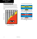
NOTE: Obstacles 200 feet and higher are included in
the Obstacle Database. It is very important to note that
not all obstacles are necessarily charted and therefore
may not be contained in the Obstacle Database.
190-00356-30 Rev F