


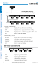

Garmin G3X MFD Quick Reference Guide
190-01055-00 Rev. A
Warnings, Cautions & Notes
WARNING: The indicators represented on the Panel are based on GPS-derived
data and may differ from the instruments in the aircraft.
WARNING: Navigation and terrain separation must NOT be predicated upon
the use of the terrain function. The G3X
™
MFD Terrain Proximity feature is NOT
intended to be used as a primary reference for terrain avoidance and does not
relieve the pilot from the responsibility of being aware of surroundings during
flight. The Terrain Proximity feature is only to be used as an aid for terrain
avoidance and is not certified for use in applications requiring a certified
terrain awareness system. Terrain data is obtained from third party sources.
Garmin is not able to independently verify the accuracy of the terrain data.
WARNING: The displayed minimum safe altitudes (MSAs) are only advisory
in nature and should not be relied upon as the sole source of obstacle and
terrain avoidance information. Always refer to current aeronautical charts
for appropriate minimum clearance altitudes.
WARNING: The altitude calculated by G3X MFD receivers is geometric height
above Mean Sea Level and could vary significantly from the altitude displayed
by pressure altimeters. Always use pressure altitude when determining or
selecting aircraft altitude.
WARNING: Do not use outdated database information. Databases used in the
G3X MFD must be updated regularly in order to ensure that the information
remains current. Pilots using any outdated database do so entirely at their
own risk.
WARNING: Do not use basemap (land and water data) information for
primary navigation. Basemap data is intended only to supplement other
approved navigation data sources and should be considered as an aid to
enhance situational awareness.
WARNING: Traffic information is provided as an aid in visually acquiring
traffic. Pilots must maneuver the aircraft based only upon ATC guidance or
positive visual acquisition of conflicting traffic.