


1. OPERATION
16
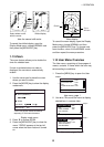
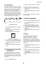
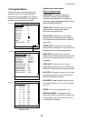
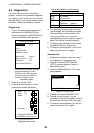
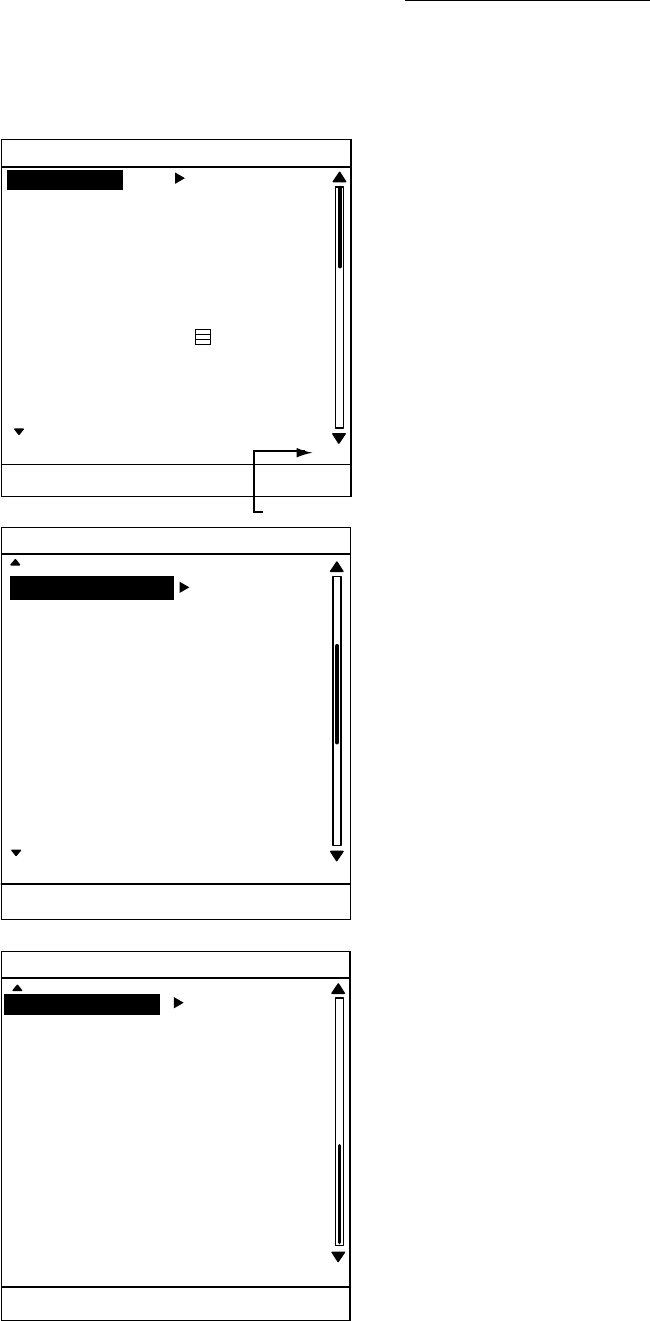
1.30 System Menu
The System menu mainly contains items
which once set do not require frequent
adjustment. You may display this menu by
choosing “SYSTEM MENU” from page 3 of
the User menu and then pressing ►.
SYSTEM MENU
LANGUAGE English
RANGE UNIT : nm
DEPTH UNIT : ft
SPEED UNIT : kt
WIND UNIT : kt
TEMP UNIT : °F
NAV DATA :
KEY BEEP : ON
RINGS : OFF
WAYPOINT MARK : OFF
(1/3)
[MENU/ESC] : Exit.
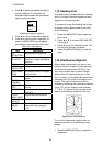
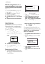
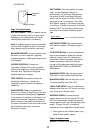
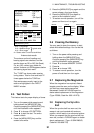
SYSTEM MENU
(2/3)
[MENU/ESC] : Exit.
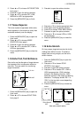
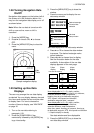
SYSTEM MENU
(3/3)
RANGE 0.125nm ON
0.25 nm : ON
0.5 nm : ON
0.75 nm : ON
1 nm : OFF
1.5 nm : ON
2 nm : OFF
3 nm : ON
4 nm : OFF
6 nm : ON
8 nm : ON
12 nm : ON
16 nm : ON
[MENU/ESC] : Exit.
PAGE 3
PAGE 2
PAGE 1
Page no.
EBL REFERENCE TRUE
BEARING READOUT : TRUE
CURSOR POSITION : RNG&BRG
TRIP SOURCE : LAT/LON
WIND SPD/DIR : APPARENT
SHIFT MODE : MANUAL
AUTO SHIFT SPEED : 15
TX SECTOR BLANK : OFF
BLANKING START : 000°
BLANKING AREA : 000°
LOCAL TIME SETUP : +0:00
ANTENNA SPEED : AUTO
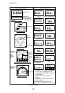
System menu
System menu description
Page 1 of system menu
LANGUAGE: The system language is
available in English, several European
languages and Japanese. To change the
language, choose language desired, and then
press the [MENU/ESC] key.
RANGE UNIT: Chooses the unit of range
measurement among nautical miles,
kilometers and statute miles.
DEPTH UNIT: Chooses the unit of depth
measurement among meters, feet, fathoms,
Hiro (Japanese) and Passi/Braza. Requires
depth data.
SPEED UNIT: Chooses the unit of speed
measurement among knot, mile per hour and
kilometer per hour. Requires speed data.
WIND UNIT: Chooses the unit of wind
measurement among mile per hour, kilometer
per hour and meters per second. Requires
wind data.
TEMP UNIT: Chooses the unit of water
temperature measurement from Celsius and
Fahrenheit. Requires water temperature data.
NAV DATA: Chooses the amount of nav data
to display among two, three and four items.
Requires appropriate sensors.
KEY BEEP: A beep sounds to confirm valid
and invalid operation. You can turn this beep
on or off.
RINGS: Turns the range rings on or off.
WAYPOINT MARK: The waypoint mark
shows the location a destination waypoint set
on a navigator. You can turn this mark on or
off. Requires a navigator.