


72
72
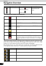
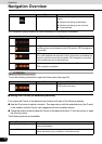
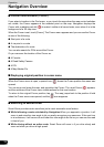
Navigation Overview
Operation
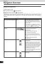
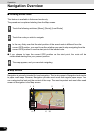
GPS reception quality shows the current accuracy of the position information.
ATTENTION
Touch the following status field to open the Quick menu (See page 50).
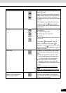
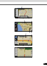
■ Using the Cursor (at selected position)
First, place the Cursor at the desired map location with one of the following options:
● Use the Find menu to select a location. The map returns with the selected point (the Cursor)
in the middle, and the Cursor menu appears with the available options.
● Touch the screen twice to place the Cursor at the desired location. Touch the cursor to open
the [Cursor] menu.
The following actions are available.
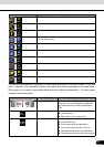
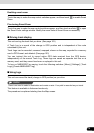
Distance information There are distance type values that can be
shown.
● Distance remaining to destination
● Distance remaining to next via point
● Current altitude
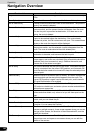
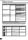
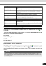
Icon Description
GPS receiver not connected. GPS navigation is not possible.
Navigation is connected to the GPS receiver, but the signal is too weak
and the receiver cannot determine the GPS position. GPS navigation is
not possible.
GPS navigation is not possible.
Only a few satellites are received. Position information is available, but
elevation (altitude) cannot be calculated. GPS navigation is possible,
but the position error may be significant.
Altitude information is available, the position is a 3D position.
GPS navigation is possible.
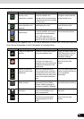
Icon Status More information
GPS position quality A higher number of lit bars indicates better
GPS position accuracy.
Touch switch Action
[Set as Destination] On an active route, use the Cursor as the destination by resetting the
previous destination.
[Insert as Via] On an active route, use cursor as via point (intermediate location)
before destination (only available in Advanced mode).
Icon Type More information