


NAV2708
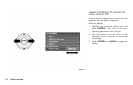
HOW TO VIEW MAP SCREEN
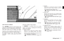
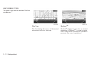
The navigation system displays various informa-
tion on the map screen.
Screen information
&
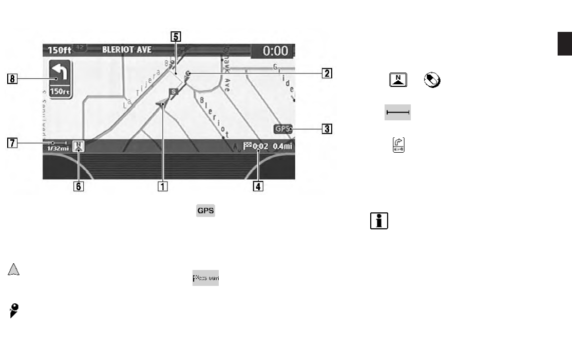
1
Vehicle icon:
Indicates the current vehicle location and
the direction that you are traveling.
&
2
Guide point:
Indicates a guide point on the route.
&
3
GPS indicator:
Indicates the GPS reception condition of
signals from the satellites.
*
Green: accurate positioning is possible
*
Gray: accurate positioning is not possible
&
4
Remaining time and distance to the
destination:
Indicates the remaining time and distance to
the destination.
&
5
Suggested route:
Appears in bold yellow during route gui-
dance.
&
6
/ Direction indicator:
Indicates the direction of the map.
&
7
Scale indicator:
Indicates the scale of the map.
&
8
Arrow and distance:
Appears on the upper left corner of the
screen when the suggested route is set.
Indicates the distance to the next guide
point and the turning direction at that guide
point. This function can be turned on or off.
INFO:
. Roads with a width of 10 ft (3 m) or less may
not be displayed on the map.
. The system may require a long time for
positioning. The GPS indicator may remain
gray for 3 to 4 minutes after the system is
started. This is not a malfunction.
OPERATING MAPS
Getting started 2-11