


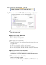
by an “x”, already uploaded photos by a “u”.
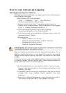
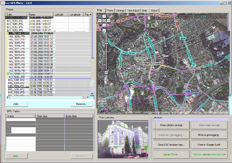
• In the list choose the photo/s you’d like to geotag.
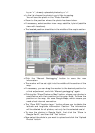
You will see the photo in the “Photo Preview”.
• Zoom to the position where the photo has been taken.
• If necessary, select another view: map, satellite, hybrid (satellite
view with locations).
• The located position should be in the middle of the map’s section.
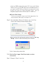
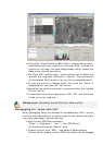
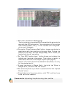
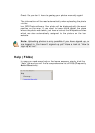
• Click the “Manual Geotagging” button to save the new
information.
• The marker will be set right into the middle of the section of the
map.
• If necessary, you can drag the marker to the desired position for
a final adjustment, and click “Manual geotagging” again.
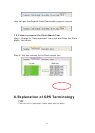
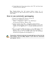
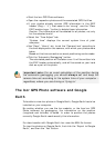
• Clicking the “Show Photos on Map” button, shows your photos in
combination with their position on the map. Note: To show the
position on the map, locr uses Google Maps, which means you
need a fast internet connection.
• The “Clear EXIF location tags…” button allows you to delete the
latitude and longitude information. Caution: The information
will be deleted for all photos, not only for the selected one/s!
• To view the photos in Google Earth, first click the “Show in
Google Earth”, and then the “Yes” button.
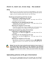
• Now select the photo/s you want to upload and click the “Upload
Photos” button.