


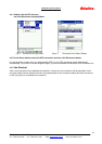


GPS-6036 Operating Manual
Rikaline
Rikaline International Corp. 14F, 171, Chen-Gong Road, SanChong City, Taipei 241, Taiwan
Tel: ++886 2 8973 1899 Fax: ++886 2 8973 1896 E-Mail: info@rikaline.com.tw
Web: www.rikaline.com.tw
6
2. Operational characteristics
2.1 Initialization
As soon as the initial self-test is complete, the GPS-6036 begins the process of satellite acquisition and
tracking automatically. Under normal circumstances, it takes approximately 45 seconds to achieve a position fix,
38 seconds if ephemeris data is known. After a position fix has been calculated, information about valid position,
velocity and time is transmitted over the output channel.
1) The GPS-6036 utilizes initial data, such as last stored position, date, time and satellite orbital data, to
achieve maximum acquisition performance. If significant inaccuracy exists in the initial data, or the orbital
data is obsolete, it may take more time to achieve a navigation solution. The GPS-6036 Auto-locate feature
is capable of automatically determining a navigation solution without intervention from the host system.
2.2 Navigation
After the acquisition process is complete, the GPS-6036 sends valid navigation information over output
channels. These data include:
1) Latitude/longitude/altitude
2) Velocity
3) Date/time
4) Error estimates
5) Satellite and receiver status
The GPS-6036 sets the default of auto-searching for real-time differential corrections in RTCM SC-104
standard format, with the message types 1, 5, or 9. It accomplishes the satellite data to generate a differential
(DGPS) solution. The host system, at its option, may also command the GPS-6036 to output a position
whenever a differential solution is available.