


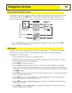
Map Screen Overview
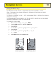
Changing Map Scale
Press the Zoom In or the Zoom Out buttons to change how much of the map is
displayed on the screen. The map scale indicator in the bottom left corner of the map
indicates the relative distance between the two end-points of the scale. The scale can
be changed from 1700 mi (2700 km) to 100 ft (35.0 m).
Tip:
Press and hold the Zoom In or the Zoom Out buttons to rapidly step through
the map scales.
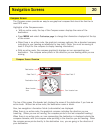
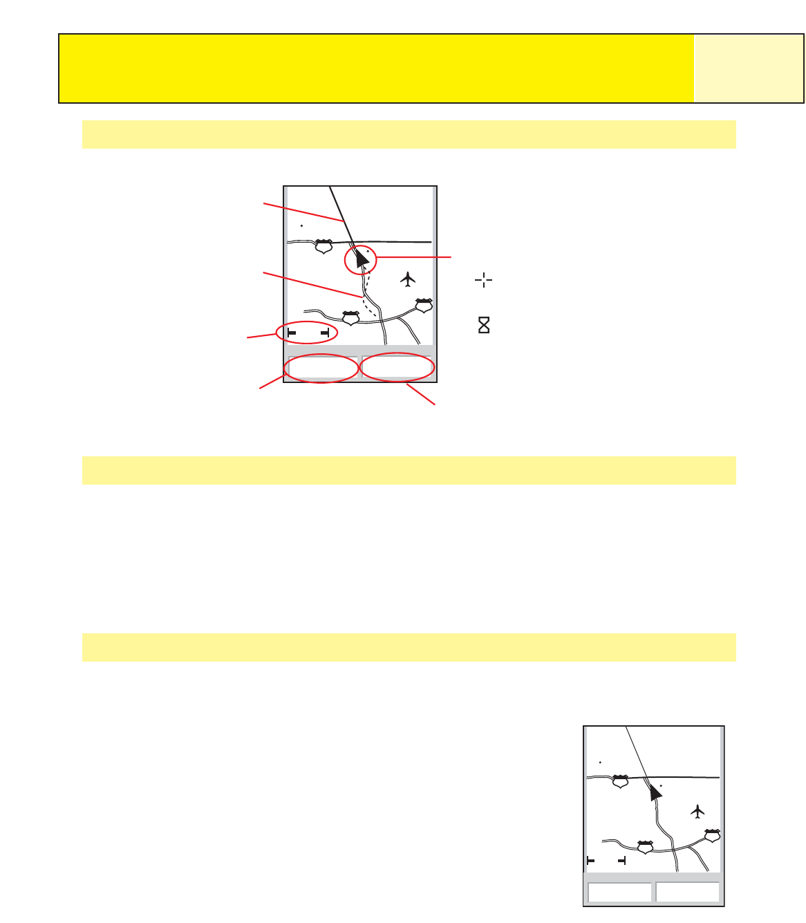
Map Screen Modes
The
Map
screen has two modes that it can be in: position or cursor. In the Position
mode the Map screen displays your position, indicated by the arrow icon in the center
of the map. The arrow not only displays your position but also,
when moving, will point in the direction you are heading.
The Position mode is the default mode for the
Map
screen.
Whenever you enter the
Map
screen it will be in the Position
mode.
Navigation Screens
15
ent
1.60mi
352
o
M
4.3
M
H
Heading
Speed
Glendora
210
vina
San Dimas
10
10
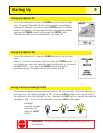
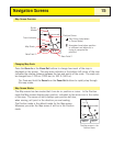
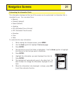
The
Map
screen in the
Position Mode
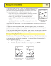
ent
1.60mi
352
o
M
4.3
M
H
Heading
Speed
Glendora
210
vina
San Dimas
10
10
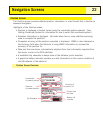
Map Scale
Data Field 1
Data Field 2
Position Cursor
Pan Cursor (used when
in Cursor Mode)
Hourglass (used when position
is unknown and eXplorist is
trying to compute the
position)
Track Indicator
Route
Marker