


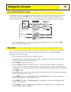
Changing the Primary Usage
The
Map
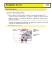
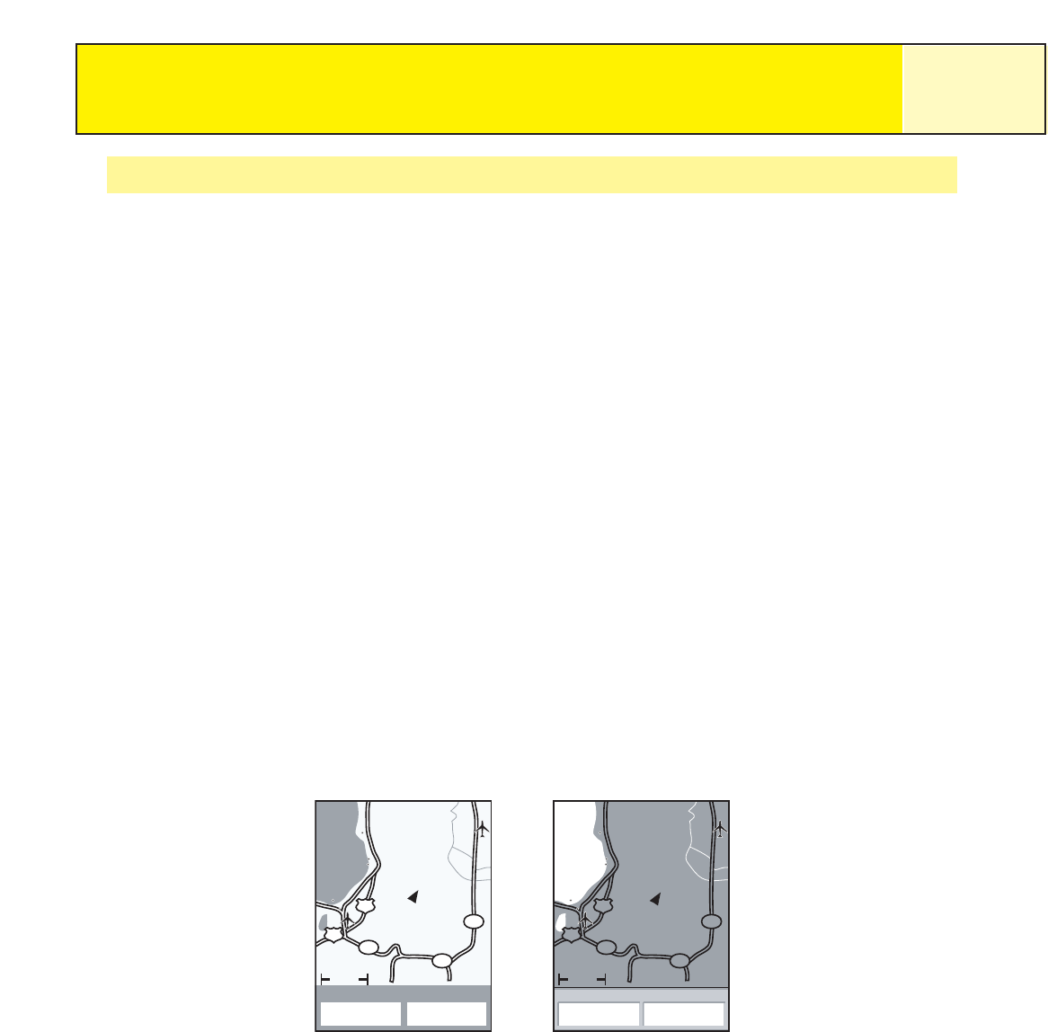
screen can be changed to be primarily used on land (default) or marine.
When in land usage, land areas are displayed as white areas on the display and water is
displayed as dark gray.
The opposite is true when the map is set for marine usage. (Water is white and land areas are
displayed as dark gray.)
This is provided as an option to provide you with the ability to view the text and map details
more easily, depending on where you are navigating.
To change the primary usage:
1. While viewing the
Map
screen, press MENU.
2. Use the Arrow joystick to highlight Map Setup.
3. Press ENTER.
4. Use the Arrow joystick to highlight the Primary Usage field.
5. Press ENTER.
6. Use the Arrow joystick to highlight Marine or Land.
7. Press ENTER.
8. Press NAV to return to the
Map
screen.
Navigation Screens
19
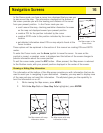
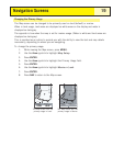
South Lake Tahoe
50
88
88
89
50
Rocky Slo
3.50mi
Heading Speed
48.0
M
H
030°M
The
Map
screen with the
primary usage in Land
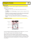
The
Map
screen with the
primary usage in Marine
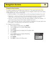
South Lake Tahoe
50
88
88
89
50
Rocky Slo
3.50mi
Heading Speed
48.0
M
H
030°M