


77
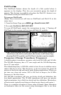
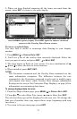
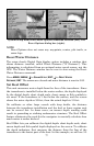
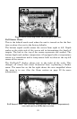
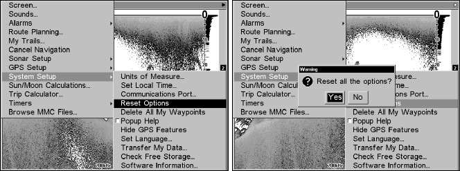
System Setup menu with Reset Options command selected (left). The
Reset Options dialog box (right).
NOTE
Reset Options does not erase any waypoints, routes, plot trails, or
sonar logs.
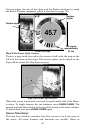
Reset Water Distance
The sonar chart's Digital Data display option includes a window that
shows distance traveled, called Water Distance ("W Distance"). This
information is calculated from an optional water speed sensor, not the
GPS. The Water Distance window can be reset to zero using the Reset
Water Distance command.
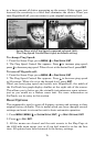
Press
MENU|MENU|↓ to SONAR SETUP|ENT|↓ to RESET WATER
DISTANCE|ENT. The menus are cleared and water distance is reset to 0.00.
Set Keel Offset
This unit measures water depth from the face of the transducer. Since
the transducer is installed below the water surface, the depth displayed
by the digital depth, chart depth scale, chart cursor or fish symbols is
not exact. If the transducer is 1 foot below the surface, and the screen
shows the water depth as 30 feet, then the actual depth is 31 feet.
On sailboats or other large vessels with deep drafts, the distance
between the transducer installation and the keel or lower engine unit
can be several feet. In those cases, an inexact depth reading could
result in grounding or striking underwater structure. The Keel Offset
feature eliminates the need for the navigator to mentally calculate how
much water is under his keel.
Keel Offset lets you calibrate the digital depth: chart depth scale, chart
cursor depth and fish symbol depth displayed on the screen. To calibrate
the depth indicators, first measure the distance from the face of the
transducer to the lowest part of the boat. In this example, we will use 3.5