


18
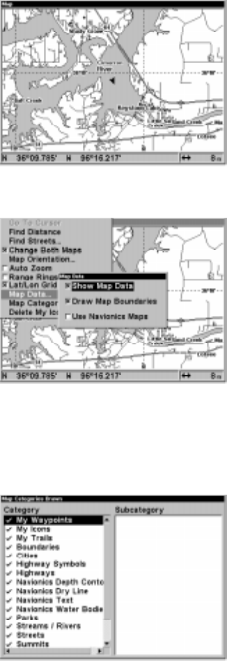
Map Categories Drawn
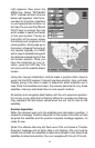
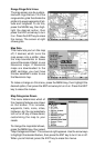
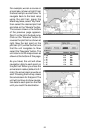
This menu determines which of
the mapping features are shown
on the screen. This includes,
waypoints, trails, icons, cities,
highways, etc. You can selectively
turn on or off any of these items,
customizing the map to your
needs.
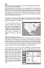
To change the map detail shown,
press the MENU key, then select
“Map Catagories Drawn”. The screen at right appears. Use the arrow keys
to highlight the desired feature, then press the ENT key to turn it on or off.
When you’re finished, press the EXIT key to erase the menus.
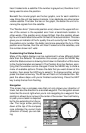
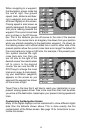
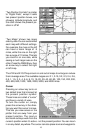
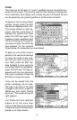
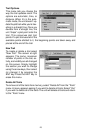
Range Rings/Grid Lines
The map screen can be custom-
ized with rings that are 1/2 of the
range and/or grids that divide the
plotter into equal segments of lati-
tude and longitude. To do this,
press the MENU key, then high-
light the desired option, then
press the ENT arrow key to turn
it on. Press the EXIT key to erase
the menus. The screen at right
shows grids.
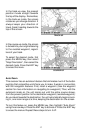
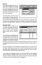
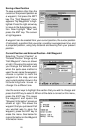
Map Data
This menu lets you turn the map
off, if desired, which turns the
map screen into a plotter; draw
the map boundaries or boxes
around the areas of detail, or use
Navionics maps. If Navionics
maps are downloaded to the
MMC cartridge, you must have
this box selected in order to use
the Navionics map.
To make a change on this menu, press the MENU key, then highlight the
desired option, then press the ENT arrow key to turn it on. Press the EXIT
key to erase the menus.