


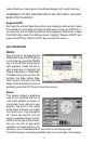

15
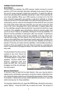
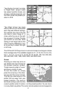
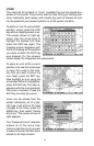
“Two Position Formats” is similar
to “Digital Data”, except it adds
two present position boxes, one
showing latitude/longitude and
the other shows the present po-
sition in UTM.
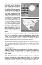
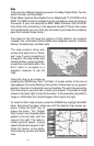
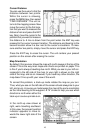
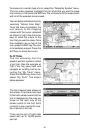
“Two Maps” shows two maps
side-by-side. You can customized
each map with different settings.
For example, the map on the left
can have a zoom range of .5
miles, while the one on the right
has a range of 10 miles. This lets
you zoom-in on one side, while
seeing a much larger area on the
other. Press the PAGES key, then
an arrow key to select the right
or left map.
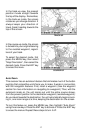
The Z-IN and Z-OUT keys zoom-in and out all maps to enlarge or reduce
their coverage area. The available ranges are: 0.1, 0.15, 0.2, 0.3, 0.4, 0.6,
0.8, 1, 1.5, 2, 3, 4, 5, 6, 8, 10, 15, 20, 30, 40, 60, 80, 100, 150, 200, 300,
400, 600, 800, 1000, 1500, 2000, 3000, and 4000 miles.
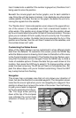
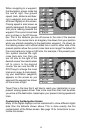
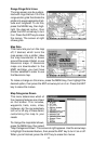
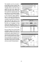
Cursor
Pressing an arrow key turns on
two dotted lines that intersect at
the present position symbol.
These lines are called a “cursor”
and have a variety of uses.
To turn the cursor on, simply
press the arrow key in the direc-
tion you want the cursor to move.
This lets you view areas on the
plotter that are away from your
present position. The zoom-in
and zoom-out keys work from the
cursor’s position when it’s active - not the present position. You can zoom
in on any detail, anywhere. The cursor can also place icons and waypoints.