97
Chart Menu Tab
To customize the chart layers:
1. Select Chart Detail Level from the Chart Menu Tab. Press the
RIGHT Cursor key to select Custom. Selecting Custom adds the
Custom Chart Layers menu to the Chart menu.
2. Press the DOWN Cursor key to select Custom Chart Layers, and
press the RIGHT Cursor key to access the submenu.
3. Use the 4-WAY Cursor key to select a layer and turn it on
(visible) or off (hidden). All changes take place immediately.
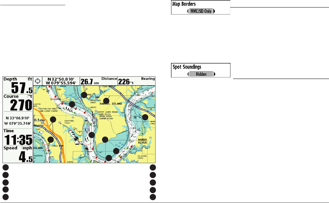
Map Borders
Settings: Hidden, MMC/SD Only, All Visible;
Default = MMC/SD Only
Map Borders allows you to display or hide map borders. The dotted lines of
a Map Border indicate an area which contains a different map. Use the
4-WAY Cursor key to move the active cursor within a map border, and press
the ZOOM + key to view the different map.
Spot Soundings
(optional-purchase Navionics® charts only)
Settings: Hidden, Visible, Default = Hidden
Spot Soundings allows you to display or hide spot soundings, which are
depth measurements shown on the chart.
NOTE: Spot Soundings are only available with optional-purchase SD cards.
Map Borders, shown with optional-purchase
Navionics® Cartography with Custom Chart Layers
Other Pointsof Interest(POI)
2
6
7
9
Navaids
3
Navigable Canals(thin, dark bluelines)
4
Roads
5
Coastline
7
Restricted Area (dottedred lines)
6
Bridge (wavyred lines)
8
Drying Lines
9
Isolated Danger:Boat Ramp
10
3
2
8
10
5
Map Borders
1
4
1


