


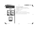

14
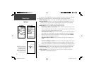
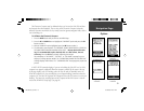
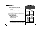
The Elevation Page provides the user with the current elevation, rate of ascent/descent,
a profi le of elevation changes over distance or time, or a profi le of pressure changes over
time (displayed in the user selectable fi eld). The Elevation Page Options Menu allows you
to select from a variety of display options such as plotting over time, plotting over distance,
displaying the zoom ranges of measurement, viewing elevation or pressure points, and
resetting data displays. A single user-selectable data fi eld allows you to display a variety of
current and recorded pressure and elevation-related data.
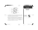
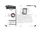
The Elevation Page provides you with a variety of elevation information: A Status Win-
dow that displays current elevation and current rate of ascent/descent, a profi le of elevation
changes over distance or time, and one user selectable data fi eld.
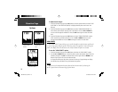
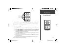
What is my elevation?
Elevation Page
Elevation Status
Elevation Profi le
Selectable Data Field
Zoom Ranges allow
the user to select the
range of measurement
over time or distance
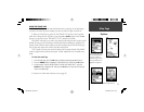
NOTE: The Altimeter should be calibrated for the greatest accuracy. Refer
to page 17 for information on calibrating the Altimeter.
)
190-00297-02_0A.indd 14 5/19/2003, 4:20:18 PM