


GPSMAP 76Cx Owner’s Manual 29
BASIC OPERATION > USING TRACKS
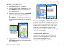
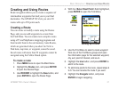
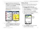
Start calculation Save calculated
track
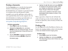
5. Press ENTER to save the new track to the
Saved Tracks list on the Tracks Page.
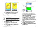
Track Profiles
After save a track, you have a record of the path you
traveled and altitude profile.
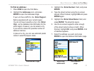
NOTE: This option is available only if Garmin
MapSource U.S. Topo 24K map data is used.
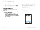
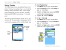
To view a track profile:
1. Open the Saved Track Page, and press
MENU.
2. Highlight Profile, and press ENTER to view
the Track Profile.
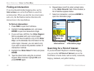
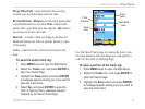
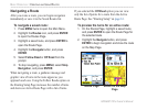
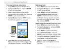
Begin
marker
End
marker
Track Profile Page
Elevation
Distance
from Begin
and End
points
The beginning of the track is marked by a
flag. You can scroll across the track profile by
pressing left on the ROCKER.
As you scroll across the profile, the elevation
for each point on the profile is shown at the
top of the page and the distance from the
Begin point and the End point are shown at the
bottom.
3. At any point along the profile, you can press
ENTER to show that point on the map.
4. Press MENU to use Zoom Ranges and Hide
Symbols options.