


82
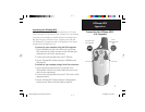
GPSmap 60CS
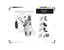
Appendices
Data Field Defi nitions
The following list provides a brief description of each data field
option. Some of these options are supported only by devices interfaced to
your GPSmap 60CS.
Accuracy GPS - The current accuracy of you GPS determined location.
Ambient Pressure - The uncalibrated current pressure.
Ascent-Average - The average vertical distance of ascents.
Ascent-Maximum - The Maximum ascent rate in feet per minute.
Ascent-Total - The total distance ascended.
Barometer - The calibrated current pressure.
Bearing - The compass direction from your current position to a destina-
tion point.
Course -
The desired path of travel from your starting point to your destina-
tion point.
Depth - The depth of water from sonar NMEA input.
Descent-Average - The average vertical distance of descent.
Descent-Maximum - The maximum descent rate in feet per minute.
Descent-Total - The total distance descended.
GPSmap 60CS Owner's Guide copy.indd 82 2/23/2004, 8:14:28 AM