


21
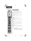
Main Menu Selections
The Main Menu turns the eTrex into a powerful
navigation tool. Features accessed from the Main Menu
are:
• Mark Waypoint: Mark your current location as a
waypoint and customize it by symbol, name, elevation,
and lat/lon.
• Waypoints: An alphabeticall list of all your waypoints.
• Route: A path to a destination marked along the way
by up to 50 waypoints.
• Tracks: A Track Log or record of your movements
which can be saved for future use.
• Setup Menu: A collection of options and controls for
customizing the operation of your eTrex unit.
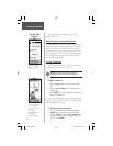
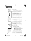
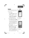
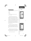
Mark Waypoint Page
The ‘MARK WAYPOINT’ Page allows you to change
the waypoint symbol, name, elevation and location
(position coordinates). The information on page 14-15
showed how to change the waypoint symbol and name.
You can also change the location (position coordinates).
You can change the elevation to the exact point if you
have that data available from a reliable source (i.e., altim-
eter or map data).
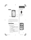
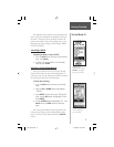
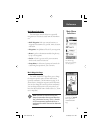
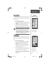
The ‘MENU’ Page
allows you to customize
the eTrex’s features.
Reference
Main Menu
Selections
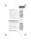
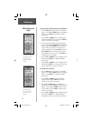
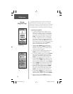
Remember that pressing
and holding the ENTER
Button gives you the
‘MARK WAYPOINT’
Page.
)
NOTE: Elevation or vertical accuracy will
always be somewhat less accurate than loca-
tion or horizontal accuracy. This is a function
of GPS measurement methods which use a
mathematical model of the earth to determine
elevation.
etrex manual.indd 21 2/19/2003, 1:37:11 PM