


v
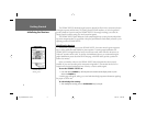
Introduction
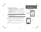
Capabilities
Designed for detailed electronic charting capability, the GARMIN GPSMAP 182/232 is a powerful
navigation device that can give you the information you need:
Precision Performance
• High-contrast, ten-level gray, LCD screen with backlighting
• 12-channel parallel receiver tracks and uses up to 12 satellites for fast, accurate positioning
• WAAS Capable — receive signals from the additional set of WAAS (Wide Area Augmentation
System) satellites to give you better accuracy.
• Differential-Ready — just add an optional GARMIN beacon receiver for better than 5-meter
accuracy
• Fully gasketed, high-impact plastic alloy case, waterproof to IEC 529-IPX-7
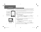
Advanced Navigating and Plotting
• 3000 alphanumeric waypoints with selectable icons and comments
• Built-in Worldwide basemap to 20 miles includes detailed ocean, river and lake coastlines,
cities, interstates, US state highways and local thoroughfares
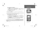
• 50 reversible routes with up to 50 waypoints each
• Uploadable maps using GARMIN’s MapSource PC products and BlueChart Data Cards
• Coordinates: Lat/Lon, UTM/UPS, Loran TD, plus 16 grids, including Maidenhead
• TracBack route feature which allows you to quickly retrace your track log to a starting position
• Built-in simulator mode
• Built-in tide information from over 3,000 tide stations around the USA coastline, Alaska,
Hawaii, western Canada and several Caribbean Islands
182_232 Manual Intro.indd 12/21/01, 11:46 AM5