


26
Reference
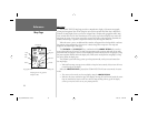
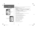
Map Page Options
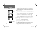
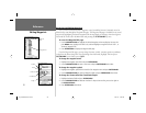
Nav Line Tab—
Heading Line— On/Off: draws an extension from the end of the boat icon in the direction of travel.
Bearing Line— On/Off: toggles the black/white line which points to the current navigation point.
Course Line— Auto, Off, 120 ft.-800 mi.: sets the maximum zoom scale at which the desired course
line should appear on the screen.
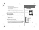
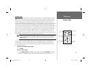
Track Tab— Saved Tracks/Track Log
Zoom— Auto, Off, 120 ft.-800 mi.: sets the maximum scale at which the feature should appear on the
screen. Some types of data will only show up to certain zoom scales.
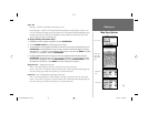
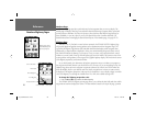
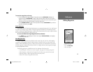
Other Tab—
Accuracy Circle— On/Off: toggles the circle “On” and “Off”. The circle represents the approximate
accuracy of the unit based on EPE, DOP, and basemap quality. You position will be within the circle.
Lat/Lon Grid— Text— None, Small, Medium, and Large: controls the screen size of the name.
Zoom— Auto, Off, 120 ft.-800 mi.: sets the maximum scale at which the feature should appear
on the screen.
Map Outlines— On/Off: toggles the coverage boxes for BlueChart/MapSource data “On” and “Off”.
• Turn Declutter On/Off — toggles between showing spot soundings and map outlines for easier
viewing.
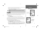
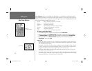
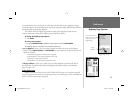
Map Setup Menu Options
From the map setup page, you can access the following menu options:
• Defaults— restores settings back to factory settings for the tab highlighted.
• All Map Defaults— restores settings back to factory settings for all tabs.
To restore defaults for map settings:
1. From the Map tab in the Main Menu, highlight the tab you want to restore settings to and press
MENU.
2. Highlight ‘Defaults’ (highlight ‘All Map Defaults’ if you want all tabs restored) and press
ENTER/MARK.
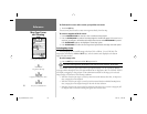
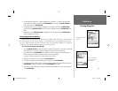
Other Tab
Map Setup
Menu Options
Track Tab
Nav Line Tab
182_232 Manual Part 1.indd 12/21/01, 11:45 AM26