


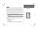
23
Map Page Options
Reference
• TO COURSE – Bearing to desired track
• TOTAL AVERAGE SPEED – Total average speed
• TOTAL TRIP TIME – Total travel time of trip, stopped and moving
• TRACK – Current compass direction of travel
• TRIP ODOMETER – Trip Odometer
• TURN – Directional amount of turn needed to match bearing
• VELOCITY MADE GOOD – Velocity Made Good to destination
• VOLTAGE – Current voltage reading being received by unit
• WATER SPEED – Speed through the water (if receiving proper sonar NMEA data from other device)
• WATER TEMPERATURE – Water temperature (if receiving proper sonar NMEA data from other device)
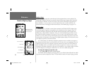
NOTE: COMPASS, HIGHWAY and POSITION will only be available on medium and large sized data fi elds.
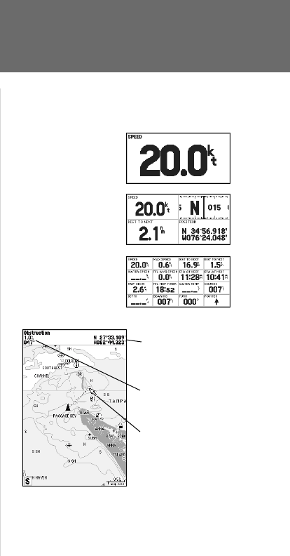
You may also choose to ‘merge’ the four medium, default data fi elds to a single, large fi eld for better
readability or you may ‘split’ any or all of the default data fi elds to show 4 small data fi elds. This option
is available from any of the main pages.
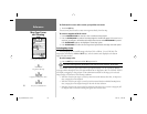
To Split or Merge the Numbers fi elds:
1. While in ‘Change Numbers’ mode, highlight the data fi eld you want to change and press MENU.
2. Choose ‘Split Number’ or ‘Merge Numbers’, then press ENTER/MARK. You will now see four new data fi elds or
one large fi eld. Press QUIT when done.
3. To return to the factory confi guration, repeat the above steps, but instead choose ‘Defaults’, then press
ENTER/MARK. Press QUIT when done.
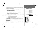
• Measure Distance— allows you to measure the bearing and distance between any two points on
the map display.
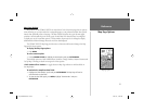
To measure the Bearing/distance between two points:
1. Highlight the ‘Measure Distance’ option and press ENTER/MARK. An on-screen pointer will appear on the map
display at your present position with ‘ENT REF’ below it.
2. Move the cursor to the desired reference point (the point that you want to measure from) and press ENTER/MARK.
3. Mov
e the cursor to the point that you want to measure to. The bearing and distance from the
reference point and cursor coordinates will be displayed in the data window at the top of the
display. Press the QUIT key to fi nish.
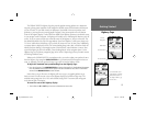
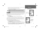
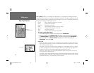
Single, large data fi eld
Default, medium fi elds
Split, small fi elds
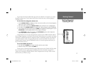
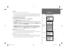
Distance and
Bearing
Map Cursor
Full screen map shown
(with BlueChart data)
Cursor
Coordinates
182_232 Manual Part 1.indd 12/21/01, 11:44 AM23