


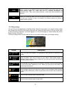

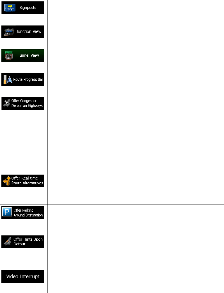
Whenever adequate informa
tion is available, lane information similar to the real
ones on road signs above the road is displayed at the top of the map. You can turn
this feature on or off.
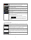
If you are approaching a freeway
exit or a complex intersection and the needed
information exists, the map is replaced with a 3D view of the junction. You can turn
this feature on or let the map be displayed for the whole route.
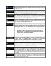
When entering tunnels, the surface roads and buildings can be disturbing. This
feature shows a generic picture of a tunnel instead of the map. A top-
down
overview of the tunnel and remaining distance are also displayed.
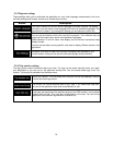
Turn on the route progress bar to see your route as a straight line on the right side
of the map. The blue arrow represents your current position and moves up as you
travel. Waypoints are also displayed on the line.
When you slow down while driving on a freeway
, there is a chance that you are in
a traffic jam so the software offers you a detour using the next exit. The message
shows you distance of the exit and the difference in distance and estimated time
compared to the original route. You can choose from one of the following options:
• Tap Dismiss or just ignore the message if you want to keep the original
route.
• Tap Preview to see the overview of the original route and the detour to
make the decision. You can accept the detour as offered or increase the
bypassed freeway segment before accepting.
• Turn to the suggested new direction and the route will be automatically
recalculated.
Similar to the above possibility, alternative routes can be suggested when driving
on normal roads. The software will select a different turn in the upcoming
intersection and offers you a different route for the next section of the route.
Your options are the similar as above but you cannot modify the offered detour.
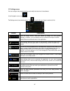
Parking at the destination may not be easy in city a
reas. As you approach the
destination, the software can offer parking category Places near your destination.
Tap the "P" button to open a top-
down map with the destination and the offered
parking Places. Select one and modify the route accordingly.
If you leave the recommended route and suddenly exit the freeway
, the application
offers different alternatives near the exit like gas stations or r
estaurants. Also, if
there are avoidable parts of the original route ahead (like a tunnel, a toll road or a
ferry), you will find them in the list in case you want to bypass them with the help of
the software.
When enabled, the device will switch back from split screen or from Audio screen
to full screen map mode during voice guidance announcements. After the voice
instruction the previous screen returns.
75