


Gives a quick but fuel efficient route based on the fuel consumption data given in
Route settings (page 70
). Travel cost and CO
2
emission calculations are
estimations only. They cannot take elevations, curves and traffic conditions into
account.
Results in a route with fewer turns and no difficult maneuvers. With this option, you
can make your software to take, for example, the freeway
instead of a series of
smaller roads or streets.
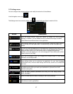
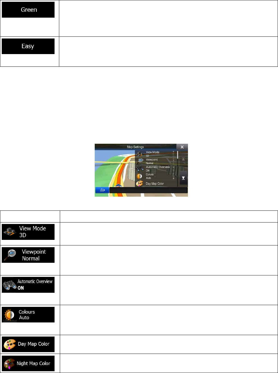
5.3.3 Map settings
You can fine-tune the appearance of the Map screen. Adjust the map view to your needs, choose suitable
color themes from the list for both daytime and night use, change the blue arrow to a 3D car model, show
or hide 3D buildings (optional), turn track logging on or off, and manage you Place visibility sets (which
Places to show on the map).
The map is always shown on the screen so that you can see the effect when you change a setting.
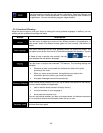
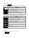
Button
Description
Switch the map view between a 3D perspective view and two 2D top-
down view
modes.
Adjust the basic zoom and tilt levels to your needs. Three preset levels are
available. There is also a manual mode when you can set the zoom and tilt levels
with the buttons on the left.
When selected, the map zooms out to show an overview of the surrounding area if
the next route event (maneuver) is far
. When you get close to the event, the
normal map view returns.
Switch between daytime and night color
modes or let the software switch between
the two modes automatically a few minutes before sunrise and a few minutes after
sunset.
Select the color scheme used in daytime mode.
Select the color scheme used in night mode.
73