


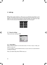

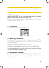
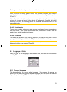

5.2 Map settings
You can set a few parameters determining the appearance of the maps in iGO.
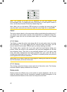
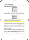
5.2.1 Daylight / Night colour profile
iGO comes with different colour schemes for both daylight and night use. There is
always one selected daytime scheme and one selected night-time scheme. iGO
uses these when switching from day to night and back.
Tap the appropriate button and select a new scheme from the list.
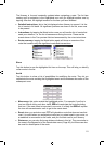
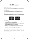
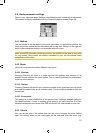
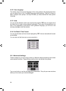
5.2.2 Cockpit / Map mode map details
The less detailed the map, the faster iGO can draw and move it. You will find that
iGO has a very fast graphic engine that is capable of moving even detailed maps at
high speed. Yet you may experience that the performance of your Car Point
PNDcan be enhanced by decreasing the amount of detail on the map.
This setting has three values: More detailed, Normal, Less detailed (fast). They
influence when iGO hides and shows certain map features while zooming in or out.
Setting a higher detail level will result in objects appearing sooner when zooming in.
Although the map visualisation of iGO is basically the same in Map and Cockpit
modes, you can set a different map detail for each one, so the map is better suited
for the purposes of that screen.
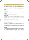
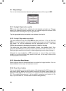
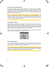
5.2.3 Alternative Road Names
Some highways have an international name or number for foreign travellers. You can
decide whether to show only the local name or both.
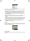
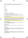
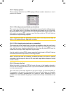
5.2.4 Show Street Labels
You can set whether or not to see the names of the streets and the POI icons on the
map when driving. Based on the current zoom and tilt levels, street names are
displayed either aligned with the street or on signposts stuck into the streets (
Page
21). If you switch these signs on, it will be easier to recognise your location on the
map, if you turn them off, it will be easier to see the road geometry.
58
GNS
GNS
GNS
GNS
GNS
GNS
GNS