


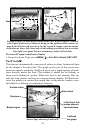
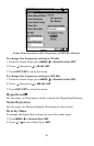
54
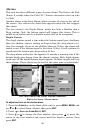
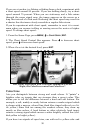
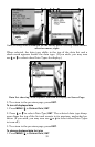
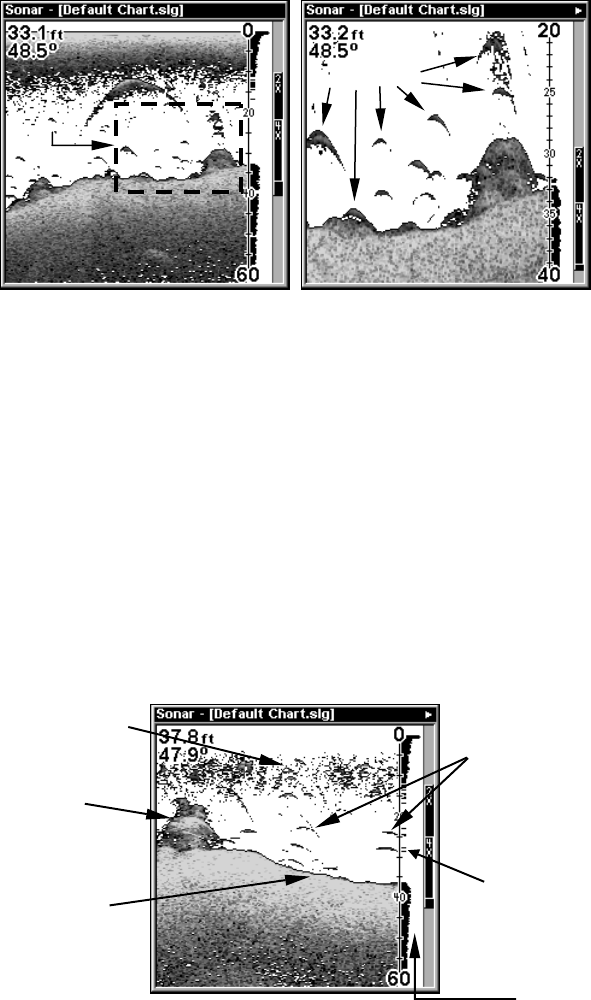
Normal display, in auto depth range mode, left. Right, display "zoomed"
with Upper and Lower Limits focusing on the portion of the water col-
umn from 20 feet to 40 feet deep. In the "zoomed" image, note the target
definition at lower left, showing a fish holding just above the structure.
Top right, two game fish are attacking a school of bait fish.
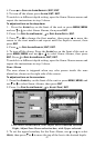
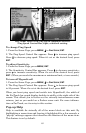
To turn off upper and lower limits
1. From the Sonar Page, press
MENU|↓ to AUTO DEPTH RANGE|ENT|EXIT.
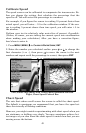
FasTrack
This feature automatically converts all echoes to short horizontal lines
on the display's far right side. The graph on the rest of the screen con-
tinues to operate normally. FasTrack gives you a rapid update of condi-
tions directly under the boat. This makes it useful for ice fishing, or
when you're fishing at anchor. When the boat is not moving, fish sig-
nals are long, drawn out lines on a normal chart display. FasTrack con-
verts the graph to a vertical bar graph that, with practice, makes a use-
ful addition to fishing at a stationary location.
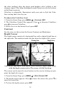
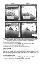
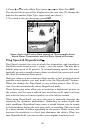
Sonar Page showing FasTrack.
Area "zoomed"
Fish arches
Surface clutter
Structure
Bottom signal
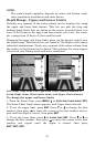
Fish arches
In FasTrack, fish
arches show as
horizontal bars.
FasTrack
bar graph