


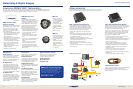

Cartography Options Part
All Navionics
®
charts www.navionics.com
NauticPath International
NP-Europe West 108-195
NP-Europe North 108-196
NP-Mediterranean 108-197
NP-Africa/Middle East/India 108-198
NP-SE Asia/Pacic Island 108-199
NP-Australia/New Zealand 108-200
NP-Japan/East Asia 108-201
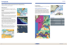
Navionics
®
Platinum+ Aerial View.
34 35
www.lowrance.com
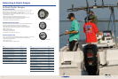
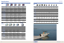
Superb coverage with powerful plug-and-play electronic charting choices for
supreme navigational awareness. Simply insert into your compatible Lowrance
chartplotter for the greatest of detail.
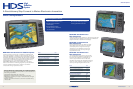
Cartography
Navionics
®
Lowrance gives a greater dimension in charting selections for all
HDS chartplotters with full Navionics
®
compatibility -- the world’s
largest and most experienced provider in worldwide electronic marine
cartography.
Platinum+
The most advanced technology and best imaging available in multi-
dimensional charts provide complete coast pilot, high-resolution
top-down photo/chart overlay, full-view panoramic pictures, improved
3D view and high-denition shing detail included on the same
chartchip. www.navionics.com for more.
Platinum
The rst and most award-winning multi-dimensional electronic charts
for chartplotters, each provide a whole new perspective for navigation
with complete coastal pilots and satellite imagery overlays and 3D
view and panoramic pictures, plus free high-denition shing detail is
now included. www.navionics.com for more.
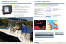
Platinum Charts Powered by TurboView™
As embedded software in all Lowrance HDS chartplotter models,
TurboView™ greatly enhances the display of all Navionics Gold and
Platinum chartcards for supreme situational awareness. The result is
seamless zooming and with Platinum transition between 2D and 3D
modes, improved shadowing for greater depth perception, real-time
overlay of nav data on 3D contour proles, and a special FlyThru
feature that integrates high-speed chart panning and zooming with
photography for a new and helpful boater perspective.
Navionics
®
chart/mapping compatibility with free HDS software upgrade in Q1 2009.
Gold
Navionics
®
Gold electronic charts are a fundamental tool of
navigation, with features tuned for serious shing and cruising such as
wrecks, port services enhancements, major coastal roads and
high-denition shing detail showing near-shore and offshore
structure, ledges and canyons. www.navionics.com for more.
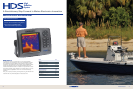
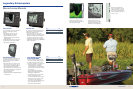
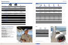
Lowrance
Excellence in coverage, detail and choices with amazing affordability
in comprehensive coastal coverage.
Cartography
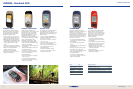
Lowrance NauticPath™ International
When going global, you can experience excellence in 2D marine
charting, preloaded on SD memory card for your Lowrance GPS.
Presenting high-level NauticPath™ offshore/coastal navigational
electronic chart detail and information, with worldwide coverage
choices, at an affordable price point compared to any other. Each
NauticPath™ International choice is preloaded on SD memory card for
plug-and-play convenience with your compatible Lowrance GPS. For
exhibits on individual chartcard coverage areas, visit the Mapping
pages of www.lowrance.com.
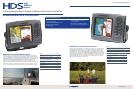
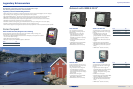
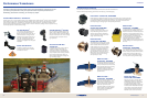
Navionics
®
Platinum+ 2D View
Navionics
®
Platinum+ 3D View
Navionics
®
Gold