


30 |
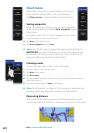
Chart | Lowrance HDS Gen2 Touch
Community edits
Turns on/off viewing of user generated data downloaded from the
Navionics website.
View
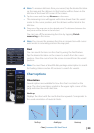
Shading
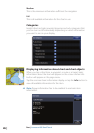
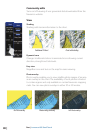
Shading adds terrain information to the chart.
Traditional 2D chart Chart with shading
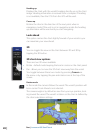
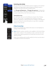
Dynamic Icons
Changes traditional stations to animated icons showing current
direction, strength and tide levels.
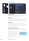
Easy view
Magnifies icons and text on the map for easier viewing.
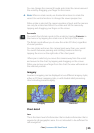
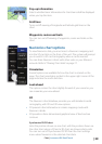
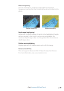
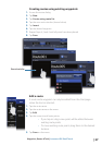
Photo overlay
Photo overlay enables you to view satellite photo images of an area
as an overlay on the chart. The availability of such photos is limited
to certain regions and only available on certain Navionics mapping
cards. You can view photo overlays in either 2D or 3D modes.
Full Photo overlayPhoto overlay, land onlyNo Photo overlay