


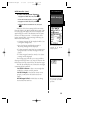
Navigation Setup
The navigation setup submenu page is used to
select units of measurement for position formats, map
datums, CDI scale, units, and heading, and speed filter
information.
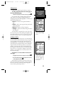
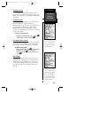
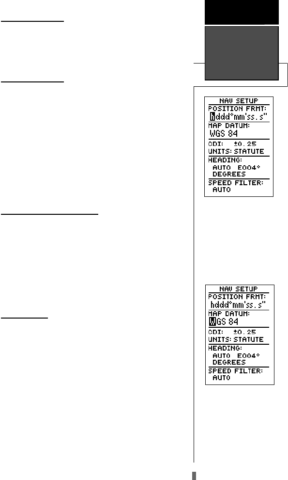
Position Formats
The default position format for the GPS 48 is lati-
tude and longitude in degrees and minutes
(hdddºmm.mmm’). You may also select degrees, min-
utes and seconds (hdddºmm’ss.s’’); degrees only
(hddd.dddddº); UTM/UPS coordinates; or British,
German, Irish, Maidenhead, Swedish, Swiss, or Taiwan,
or User grid formats.
To select a position format:
1. Highlight the ‘POSITION FRMT’ field, and press
E
.
Select the desired setting, and press
E
.
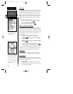
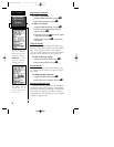
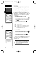
User Grid Position Format
The user grid option lets you create a user defined
position format by establishing factors such as longi-
tude of origin, scale, and false Easting or Northing.
To define a user grid:
1. Select ‘User Grid’, and press
E
. Enter values for
longitude origin, scale, and false Easting and
Northing, and press
E
. Highlight ‘SAVE?’, and
press
E
.
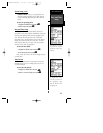
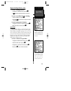
Map Datums
The ‘MAP DATUM’ field comes with a WGS 84
default setting. Although 106 total map datums are
available for use (see Appendix D for map datums),
you should only change the datum if you are using
maps or charts that specify a different datum than
WGS 84.
49
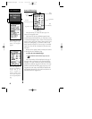
The position format may
be set to display your
choice of many formats.
Note: degree and minutes
is the default setting.
REFERENCE
Navigation
Setup &
User Grid
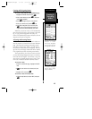
The default map datum
covers world-wide naviga-
tion. However, if you are
using a paper map or
chart which uses a differ-
ent map datum than WGS
84, then you may wish to
switch to that datum.
GPS48revB.qxd 1/7/00 3:12 PM Page 49