


09/25/02 GPS_field_guide 8:19 A9/P9
17
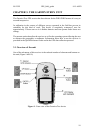
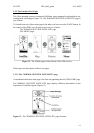
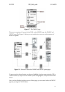
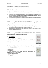
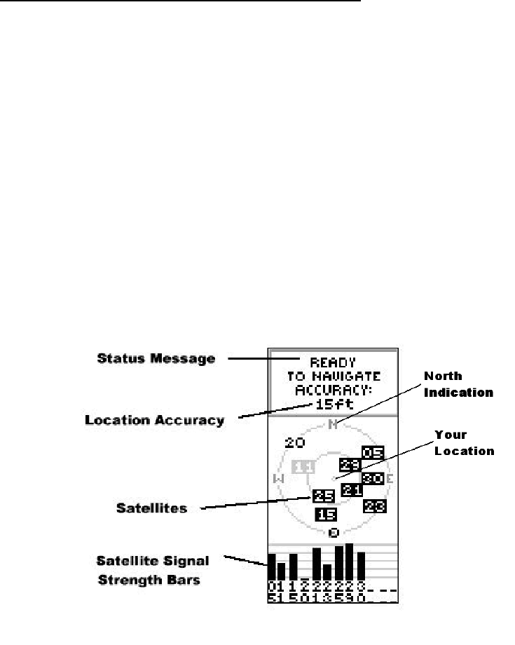
The 'ADVANCED SKYVIEW SATELLITE' page
This page contains the same elements as the 'NORMAL SKYVIEW SATELLITE' page but
presented in a different graphical way (Figure 16).
This display gives more information about the location of the satellites in the sky
(represented as a numbered square) around your location (the point at the centre of the
screen).
In the Figure 16, the GPS device is surrounded by 9 satellites, 7 of them have a signal
strong enough to be received (square in black) one (in grey) having a signal not strong
enough and the last one not being read by the device (the n°20).
This display is very helpful to check the Positional Dilution of Precision (PDOP) (see
section 1.3). In case you have difficulty finding satellites, because it also can help you
to identify obstacles that might block the signal (such as buildings, mountains…). For
that you may use the North indication on the screen to orient the unit.
Figure 16 - 'ADVANCED SKYVIEW' page
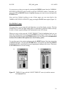
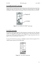
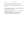
3.2.3.2 The 'MENU' page
The 'MENU' page (Figure 17) presents a list of options as well as the indication of the
Time/Date and Battery strength. This last element can help the user to identify when to
replace the batteries.