


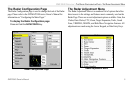

4 GMR 20/40 Owner’s Manual
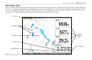
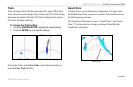
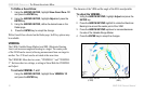
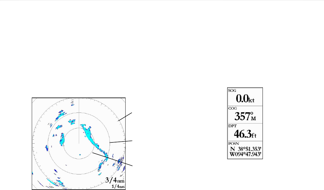
Range Rings
The Range Rings are used as an aid to quickly determine distance to
a target. In the lower right corner of the display are two scales. The
upper scale is the current zoom scale. This scale is changed using the
RANGE keys. The Zoom Scale is represented by the Range Ring
with tick marks around the circumference. The tick marks are arrange
with a minor tick marks every five degrees and major tick marks
at thirty-degree increments. These tick marks can aid in quickly
determining the azimuth to a target. The lower scale represents the
distance between the Range Rings.
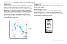
Heading Line
The Heading Line is shown from your current position along the path
of your current heading.
Digital Navigation Data
By default, the Radar page shows one column of digital navigation
data with four data fields. The Radar page can be configured to show
two columns of data with up to seven data fields each. Each data field
can be configured to show a variety of data.
3/4 nm
1/2 nm
1/4 nm
GMR 20/40 OPERATION > RANGE RINGS—HEADING LINE—DIGITAL NAVIGATION DATA