


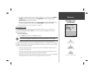
31
Reference
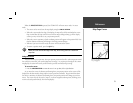
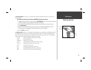
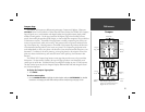
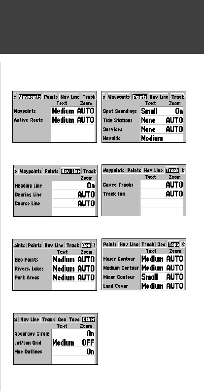
Map Page Options
Waypoints Tab— Waypoints, Active Route
Text and Zoom settngs, see the description on page 30 for details.
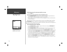
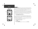
Points Tab— Spot Soundings, Tide Stations. Services, Navaids
Text and Zoom settngs, see the description on page 30 for details.
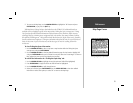
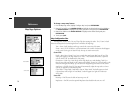
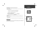
Nav Line Tab
Heading Line— On/Off: turns the Heading Line on or off. The Heading Line projects from the
tiranle showing your current heading.
Bearing Line— Auto, Off, 20 ft-800 mi: sets the maximum scale at wihch the Bearing Line
should appear on the screen The Bearing Line shows the bearing from your current location
to a destination waypoint.
, Course Line— Auto, Off, 20 ft-800 mi: sets the maximum scale at which the Course Line
should appear on the screen, The Course Line shows a direct navigation line from the point
navigation was initiated to a destination waypoint.
Track Tab— Saved Tracks, Track Log
Zoom settng, see the description on page 30 for details.
Geo Tab— Geo Points, Rivers/Lakes, Park Areas
Text and Zoom settngs, see the description on page 30 for details.
Topo Tab— Major/Medium/Minor Contours, Land Cover
Text and Zoom settngs, see the description on page 30 for details.
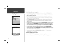
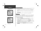
Other Tab
Accuracy Circle— On/Off: toggles the circle “On” and “Off”. The circle represents the approxi-
mate accuracy of the unit based on EPE, DOP, and basemap quality. You position will be
within the circle.
Lat/Lon Grid—Text and Zoom settings determine when the grid and lables will be displayed on
the Map Page. See the description for the Text and Zoom settings on page 30 for details.
Map Outlines—On/Off toggles the outline showing areas of MapSource Data that are loaded
in the unit.
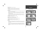
Points Tab
Topo Tab
Nav Line Tab
Geo Tab
Other Tab
Waypoints Tab
Track Tab