


011
F400
010
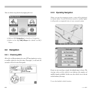
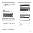
2.2.2. Operating Navigation
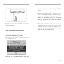
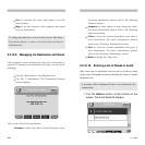
When you start the navigation system, a map will be displayed
as shown below. If your GPS device receives a satellite signal,
it will provide an expanded view of your current location.
If you are not receiving a signal, the default map is shown. The
varying colors of the vehicle icon indicate the number of
satellite signals available. In this case, the vehicle icon is shown
at the bottom of the map.
To see the detailed vehicle location:
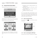
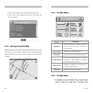
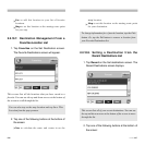
You can choose any function by tapping the icon.
Refer to 2.2. Navigation for details on Navigation.
Refer to the 2.3. MP3 Player for details on MP3
Player.
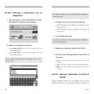
2.2. Navigation
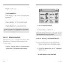
2.2.1. Checking GPS
Allow five to fifteen minutes for your GPS navigation to receive
a satellite signal for the first time. Thereafter, it will take 90
seconds or less to receive the signals.