


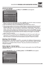
XNAV3500P PORTABLE GPS NAVIGATION SYSTEM
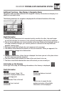
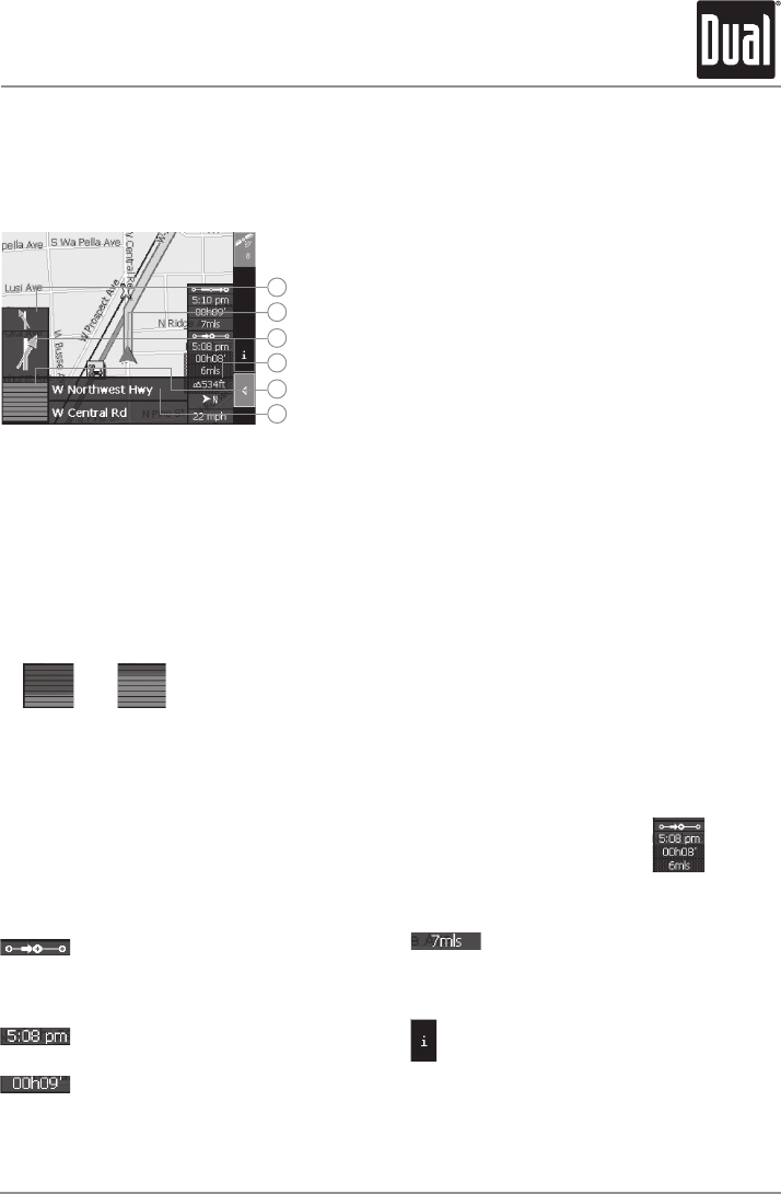
Additional Functions - Map Display in Navigation Mode
Navigation mode provides assistance for navigation, itinerary information and display of an
additional command button.
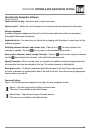
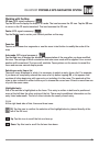
The following assistance for navigation is displayed at the left and at the bottom of the map:
Field Information
1. If there are two maneuvers to be executed quickly one after the other, the small upper
arrow field indicates the maneuver to be executed immediately after the first maneuver.
2. The red arrow indicates your current position on the map. Because the displayed sector of
the map constantly changes, your current position is centered on the map whenever
possible (moving map).
3. The larger arrow field indicates the next maneuver to be executed.
4. The distance field indicates the distance to the next maneuver. When you approach, the
representations change into a distance bar:
5. The greater the number of bars that are displayed, the closer you are to the place where
the next maneuver must be executed.
6. The upper street field indicates the name of the next street to turn on.
7. The lower street field indicates the name of the street you are currently on.
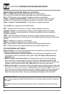
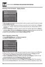
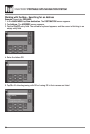
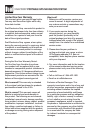
Information on the Itinerary
At the right of the map, the following information on the itinerary is displayed:
Field information
This symbol means “stage.” All
information displayed below refers
to the next stage point.
ETA (Estimated Time of Arrival).
Remaining time to arrival
(estimated).
Remaining distance to arrival
(estimated).
Tap this icon to repeat the last
spoken instruction. All available
information will be displayed.
1
2
3
4
5
6
27