


EN
20
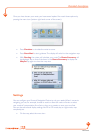
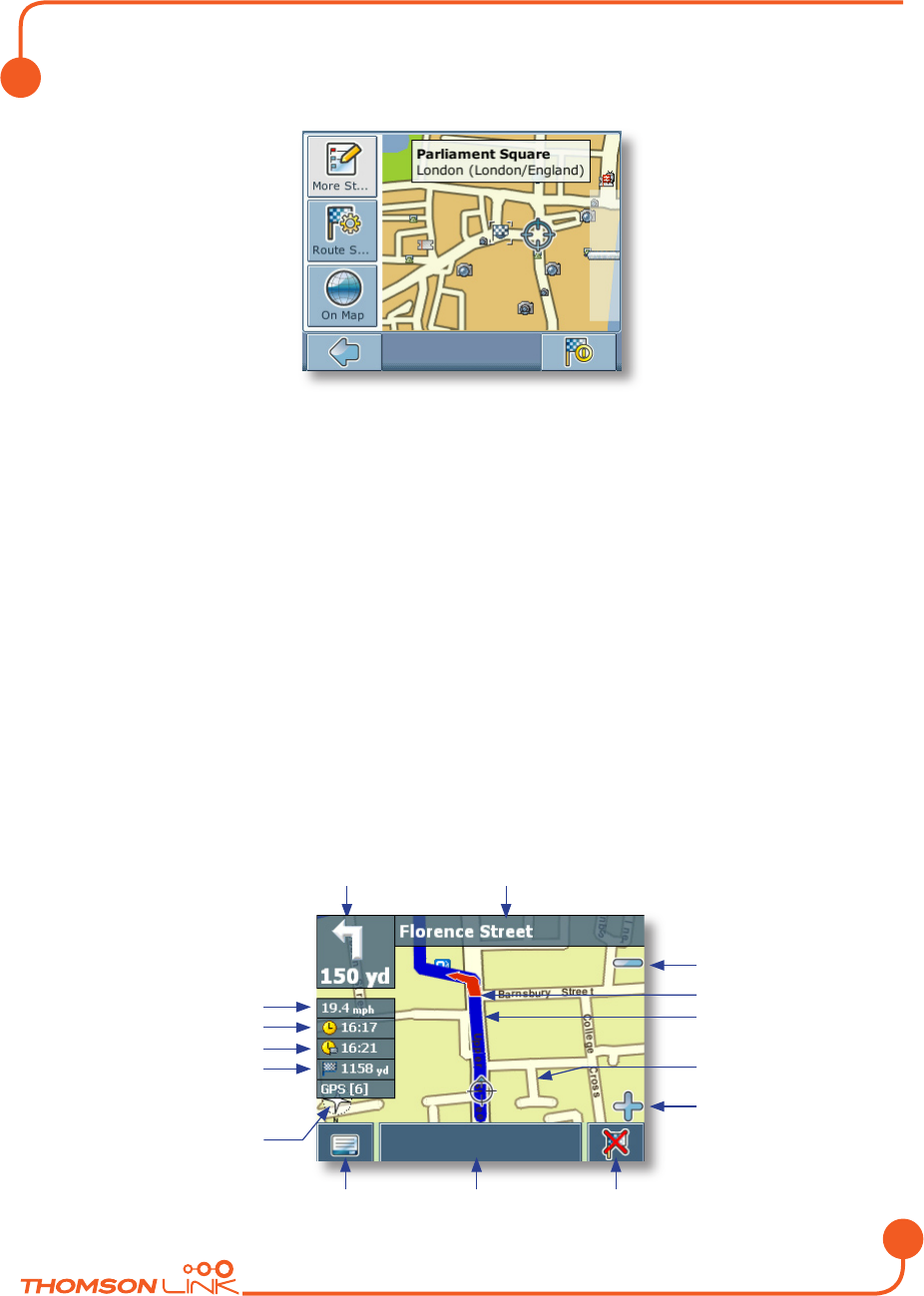
The location will be shown in the navigation map:
• Press the navigation icon to be guided to the location.
• Press More Stopovers
to use the location for routing (see “Planning a route”
on page 22).
• Press Route Settings
to alter the guidance settings (see “Route options” on
page 25).
• Press On Map
to show the location on the map.
Your route will be calculated. The navigation screen will be displayed.
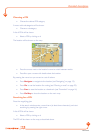
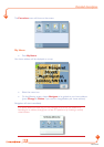
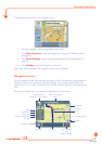
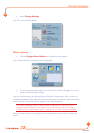
Navigation screen
On the navigation screen, the route will be shown in blue. The red arrow will indicate the
direction of your next manoeuvre. Crosshairs identify your current position. When you
come up to a turn or other manoeuvre, you will hear a voice command at the appropriate
time.
For one-way streets, the transit direction is indicated with a red arrow.
Manoeuvre icon
Distance to next manouvre
Next turn/junction/
exit no
Zoom out
Direction
Route
Cur
rent position
Zoom in
Menu icon Info box Stop navigation
OR
Follo
w route again
Speed
Distance to destination
GPS inf
ot
Compass rose
Current time
Arrival time
Detailed description
Edition 2006