


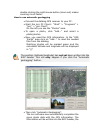

Geotagging with the locr PC Client
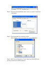
To geotag your photos automatically you have to
download and install the locr PC Client.
Manual or automatic geotagging?
There are two ways to geotag your photos: The photos
can be tagged manually or automatically. For automatic
geotagging you need a datalog GPS receiver in addition
to your digital camera. If you want to view your
geotagged photos on Google Maps, you have to be
connected to the Internet.
Tip: Geotagging adds information to your photos. Therefore, locr
recommends you to safe the original photos to a backup folder
before geotagging them with the locr PC Client!
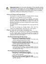
How to use manual geotagging
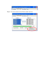
Geotagging using the address
Geotagging using the address is an easy way to find out
the position where a photo was taken.
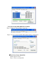
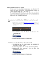
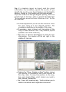
• Start the locr PC Client: “Start” > “Programs”
>”locr” > “locr Client”.
On the left you see the “Photos” area.
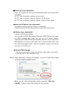
• To open a photo, click “Add...” and select a
photo/photos.
• In the list choose the photo/s you’d like to geotag.
You will see the photo in the “Photo Preview”.
• If you know exactly where the photo had been taken,
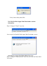
enter the address and click “Search”.
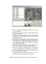
Address can be:
o Street, number, city, country, ...
Example: Kurfürstendamm 12 Berlin
Germany
o Geographic locations, country
Example: Zugspitze Germany
Please note: The correct order is important, whereas a comma is
not needed between the search criteria.