


17
TRACKER 5600 Installation and Operation Manual
NAVMAN
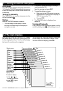
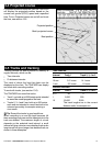
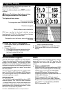
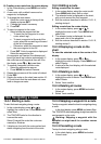
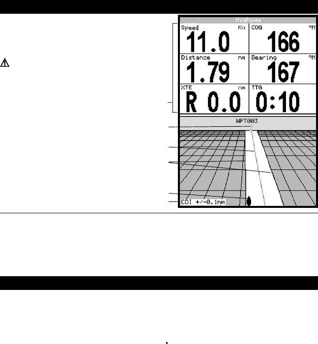
6 Highway display
The highway display has a bird’s eye view of the
boat’s course to a destination:
To go to the highway display, press
DISP and select
Highway
.
Warning: The highway display does not show
land, dangerous waters or chart symbols.
CDI lines, parallel to the boat’s plotted course
(see Appendix C, CDI). The CDI lines are like a highway
over the water where the boat will move.
Six numeric data fields
To change what data is displayed, see below
Boat position is at the bottom, centre of the display
CDI scale
Boat’s plotted course to destination
The highway display shows:
Destination waypoint
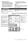
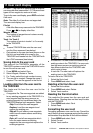
Change the numeric data display
1 In the highway display, press MENU and select
Data setup
.
2 Change a data field:
i Press the cursor keys to highlight the field.
ii Press ENT to display a menu of the data
that can be shown in the field.
iii Select the data to show in the field; select
None
to leave the field empty.
3 Repeat the above step to change other fields.
4 Finally, press ESC to return to the highway
display.
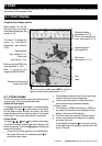
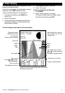
GPS worldwide navigation
The US Government operates the GPS system.
Twenty-four satellites orbit the earth and broadcast
position and time signals. The positions of these
satellites are constantly changing. The GPS receiver
analyses the signals from the closest satellites and
calculates exactly where it is on earth. This is called
the GPS position.
The accuracy of the GPS position is typically better
than 10 m (33 ft) for 95% of the time. A GPS antenna
can receive signals from the GPS satellites when it
is almost anywhere on earth.
GPS antennas
The TRACKER must be used with the external GPS
antenna supplied. The TRACKER has a sensitive
12-channel receiver built in, which tracks signals from
all satellites visible above the horizon and uses
measurements from all satellites more than 5° above
the horizon to calculate the position.
7 Satellites
DGPS
A DGPS system uses correction signals to remove
some of the errors in the GPS position. The
TRACKER can use one of two types of DGPS
system:
WAAS and EGNOS DGPS
WAAS and EGNOS are two satellite based DGPS
systems. The correction signals are broadcast by
satellites and are received by the TRACKER’s
standard GPS antenna. The accuracy of the
corrected GPS position is typically better than 5 m
(16 ft) for 95% of the time.
WAAS covers all of the USA and most of
Canada. EGNOS will cover most of Western
Europe when it becomes operational about the
end of 2003. To enable WAAS and EGNOS
DGPS, (see section 13-3).