20
TRACKER 5100/5100i/5500/5500i Installation and Operation Manual
NAVMAN
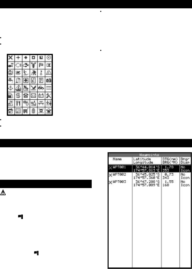
To go to the waypoints display, press DISP and select
Waypoints (see right).
The waypoints display is a list of the waypoints that
have been entered, each with waypoint symbol,
name, latitude and longitude, distance and bearing
from the boat, type and display option.
9-2 Managing waypoints
Warning: Do not create a navigation waypoint
on land or in dangerous water.
9-2-1 Creating a new waypoint
Creating a new waypoint from any display
Press
. A new waypoint is created at the boat
position with the default name and data. To
change the default data, (see section 9-2-3).
Creating and editing a new waypoint from the
chart display
1 To create a waypoint at the boat position, press
ESC to switch the chart to centre on boat
mode (or press
, see above).
Or, to create a waypoint at a different point,
move the cursor to that point on the chart.
2 Press MENU and select New waypoint.
3 A new waypoint, with the default name and
data is created.
9 Waypoints
9-1 Waypoints display
A waypoint is a position of interest that is saved by
the TRACKER, for example a fishing spot or a point
on a route. The TRACKER can have up to 500
waypoints. A waypoint can be created, changed or
deleted. A waypoint has:
A name (up to eight characters).
An icon showing what kind of waypoint it is.
The available icons are:
A position.
A colour (TRACKER 5500, 5500i) for the
waypoint symbol and name on the chart.
A type:
Normal: A normal waypoint can be
navigated to or included in a route.
Danger: A danger waypoint is a point to
avoid. If the boat comes within the danger
radius of a danger waypoint the unit can
sound an alarm (see section 13-6).
A display option:
Controls how the waypoint is displayed when
the Waypoints setup option is set to Selected
(see section 13-2):
Off: The waypoint is not displayed.
Icon: The waypoint icon is displayed.
I+N (Icon and Name): The waypoint icon
and name are displayed.
If there are many waypoints, use this feature to
select which waypoints are displayed on the
chart.
Note: the other choices for the “Waypoints”
setup option are “Hide all” (no waypoints are
displayed on the chart) and “Show all” (all the
waypoints are displayed on the chart) (see
section 13-2).


